Colle San Bernardo di Mendatica
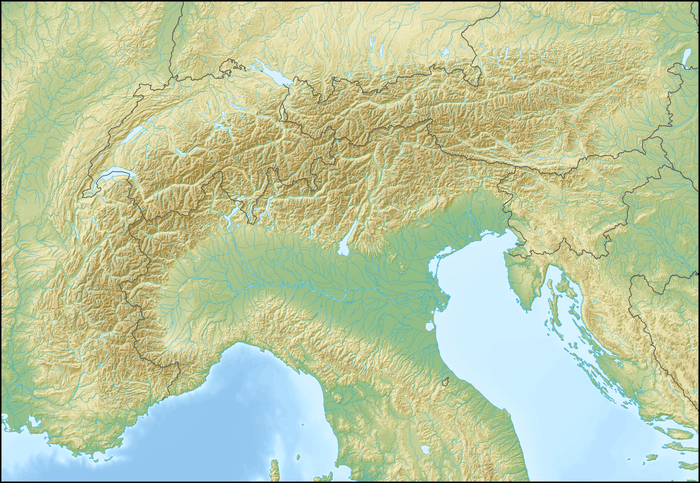
Colle San Bernardo di Mendatica (1262 m) is a mountain pass in the Province of Imperia (Italy). It connects Colle di Nava with Mendatica, Colla del Garezzo and Monesi (Triora), all located in the Province of Imperia.
| Colle San Bernardo di Mendatica | |
|---|---|
 | |
| Elevation | 1,262 m (4,140 ft).[1] |
| Traversed by | Provincial roads 74, 100, 2 |
| Location | Liguria, Italy |
| Range | Ligurian Alps |
| Coordinates | 44°05′06″N 7°46′59″E |
 Colle San Bernardo Location of the pass | |
Geography
Colle San Bernardo di Mendatica is located on the main chain of the Alps. It connects the basins of Ligurian Sea (south of the pass) and Po. Administratively it belongs to Mendatica municipality.[1]
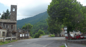
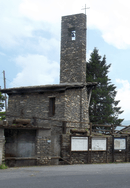
Near the pass is located a small touristic village [2] with several holiday houses, some hotels, restaurants and a small church.
Hiking
The pass is also accessible by off-road mountain paths and is crossed by the Alta Via dei Monti Liguri, a long-distance trail from Ventimiglia (province of Imperia) to Bolano (province of La Spezia).[3]
See also
References
- Limiti Amministrativi (Comunali, Provinciali, Regionali) sc. 1:25000 - ed. 2011; Regione Liguria, see geoportale.regione.liguria.it (access: December 2015).
- Liguria, AA.VV.; Touring Club Italiano, 1982, pag. 443, see google books (access: December 2015)
- "San Bernardo di Mendatica - Colle di Nava". www.parks.it. Retrieved December 5, 2015.
External links
![]()