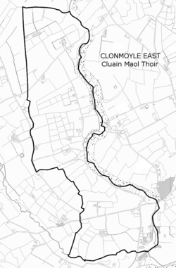
Clonmoyle East
Clonmoyle East is a townland within both the civil parish and catholic parish of Aghabullogue, County Cork, Ireland. It is 756.05 acres in size, situate east of Aghabullogue village, and north of Coachford village.
Clonmoyle East Irish: Cluain Maol Thoir | |
|---|---|
 | |
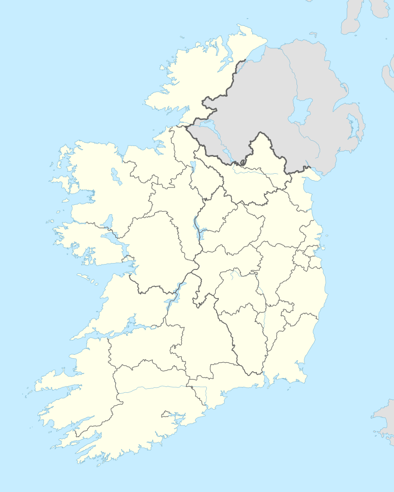 Clonmoyle East Clonmoyle East shown within Ireland | |
| Coordinates: 51°56′36″N 8°47′8″W | |
| Country | Ireland |
| County | County Cork |
| Barony | Muskerry East |
| Civil parish | Aghabullogue |
| First recorded | Mid 17th Century |
| Settlements | Aghabullogue, Coachford |
| Government | |
| • Council | Cork County Council |
| • Ward | Blarney-Macroom EA |
| Area | |
| • Total | 305.96 ha (756.05 acres) |
| Irish grid ref | W457771 |
It is referred to as 'Clonmoile' in the Down Survey (Muskerry) map,[1] and 'Clonmolye' with arable and course pasture land in the Down Survey (Parishes of Ahabollog and Aghinagh) map, with the terrier naming the proprietor as an Irish papist, Cormack MacCallaghan Carthy of the 'denomination of Clonmoyle', consisting of three ploughlands and c. 1521 acres considered 'entirely profitable'.[2] The present combined acreage of Clonmoyle East with the adjoining townland of Clonmoyle West is c. 1530 acres.
The Ordnance Survey name book (c. 1840) gives the Irish language version of Cluain Maoile to the townland, or 'meadow of the hornless cow'. It was said to be the property of Rev. J.L. Pyne and Molly Davis, and excellent ground, mainly cultivated, with some bog and furze running through it. O'Donoghue (1986) holds the Irish version to be Cluain Mhaoil, meaning 'bare or bleak watershed', or possibly Cluain Maothaile meaning 'soft or spongy watershed'.[3] O'Murchú (1991) holds the correct version to be Cluain Mhaol meaning 'the bare meadow'.[4] The Placenames Database of Ireland gives an Irish name of Cluain Maol Thoir to the townland, with cluain meaning 'meadow' or 'pasture', and maol meaning 'bare' or 'flat-topped hillock', .[5]
Townlands vary greatly in size, being territorial divisions within parishes in Ireland. Extensively used for land surveys, censuses and polling systems since the seventeenth century, townlands have also been used as the basis for rural postal addresses. In County Cork, surveying and standardisation of townland names and boundaries by the Ordnance Survey during the mid-nineteenth century, resulted in some earlier townland names disappearing, due to amalgamation or division. The townlands resulting from such surveys were employed during the Primary Land Valuation (Griffith's Valuation), subsequent censuses, and continue in use today.
|
|
|
Townland sites/items of interest
- Clonmoyle House
- Clonmoyle Mill
- Leader's Aqueduct
- Cottage House, Clonmoyle
- Athnanangle Bridge
- Luskin's Bridge
- Colthurst's Bridge
References
- "Down Survey map 1656-8, (Barony of Muskery)". Retrieved 19 April 2014.
- "Down Survey map 1656-8 (Ahabollog and Aghinagh)". Retrieved 19 April 2014.
- O'Donoghue, B. (1986). Parish histories and place names of west Cork. Kerryman Ltd.
- O'Murchú, M. (Dec 1991). "Place names of the parish of Aghabullogue". Coachford Record. 2.
- "Placenames Database of Ireland". Archived from the original on 21 April 2014. Retrieved 19 April 2014.
- Histpop; Area, population and number of houses, Vol. II, Ireland, 1881, page 256
- HistPop; Area, houses, and population, Munster, Ireland,1911 Page 93
- "Grand Jury map of County Cork" (PDF). Retrieved 19 April 2014.