Clark, Colorado
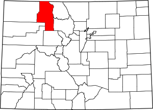
Clark is an unincorporated community and U.S. Post Office in Routt County, Colorado, United States. The Clark Post Office has the ZIP Code 80428.[2]
Clark, Colorado | |
|---|---|
The Clark Store in Clark. | |
 Clark, Colorado Location within the state of Colorado | |
| Coordinates: 40°42′26″N 106°55′08″W | |
| Country | |
| State | |
| County | Routt County |
| Elevation | 7,260 ft (2,213 m) |
| Time zone | UTC-7 (MST) |
| • Summer (DST) | UTC-6 (MDT) |
| ZIP Code | 80428[2] |
Geography
Clark is located at 40°42′26″N 106°55′08″W (40.707255,-106.918752).
gollark: It's actually GNU/Wordart, not Wordart.
gollark: The bot seems rather judgemental though, I must say.
gollark: 1.00000000003 miles
gollark: It just seems weird that they defined one of the base units as 1000 of some unit.
gollark: We can't rename kilograms grams without confusing everyone who doesn't also adopt that, but I guess renaming them to "standard weight units" or some abbreviation would work.
See also
- Outline of Colorado
- State of Colorado
- Colorado cities and towns
- Colorado counties
References
- "US Board on Geographic Names". United States Geological Survey. 2007-10-25. Retrieved 2008-01-31.
- "ZIP Code Lookup". United States Postal Service. December 15, 2006. Archived from the original (JavaScript/HTML) on September 3, 2007. Retrieved December 15, 2006.
External links
| Wikimedia Commons has media related to Clark, Colorado. |
This article is issued from Wikipedia. The text is licensed under Creative Commons - Attribution - Sharealike. Additional terms may apply for the media files.

