Cima di Jazzi
The Cima di Jazzi (English: Jazzi Peak) is a mountain of the Pennine Alps, located on the Swiss-Italian border, just north of Monte Rosa. It overlooks Macugnaga on its east (Italian) side. The west (Swiss) side is entirely covered by glaciers.
| Cima di Jazzi | |
|---|---|
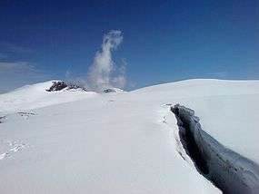 Cima di Jazzi (left) from west | |
| Highest point | |
| Elevation | 3,803 m (12,477 ft) |
| Prominence | 243 m (797 ft) [1] |
| Parent peak | Monte Rosa |
| Coordinates | 45°58′51.9″N 7°53′40.9″E |
| Geography | |
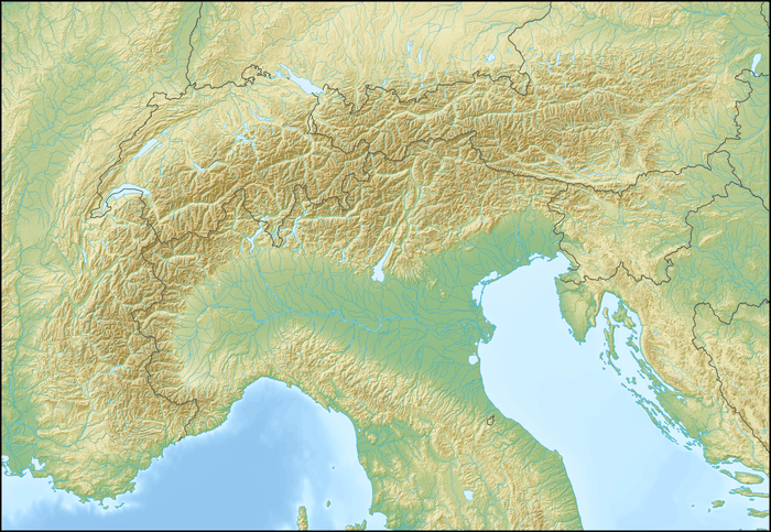 Cima di Jazzi Location in the Alps | |
| Location | Valais, Switzerland Piedmont, Italy |
| Parent range | Pennine Alps |
Geography
The SOIUSA partition of the Alps places the mountain in the Monte Rosa group of the alpine subsection Eastern Aosta and Northern Valsesia Alps (Pennine Alps); its code is: I/B-9.III-A.3.a.[2]
Mountain huts
- Rifugio Eugenio Sella,
- Bivacco Città di Luino,
- Monte Rosa Hütte.
gollark: Overall, IQ and literacy have apparently been trending vaguely upward for ages.
gollark: The internet and also to some extent news system make stupidity very visible.
gollark: In America? Oh dear.
gollark: As far as I can tell with my very limited knowledge of German, they are complaining about the Utsuho Reiuji thing again.
gollark: You can just edit permissions so the bots can't see some channels.
References
- Retrieved from the Swisstopo topographic maps. The key col is the Altes Weisstor (3,560 m).
- Marazzi, Sergio (2005). Atlante Orografico delle Alpi. SOIUSA (in Italian). Priuli & Verlucca. ISBN 978-88-8068-273-8.
This article is issued from Wikipedia. The text is licensed under Creative Commons - Attribution - Sharealike. Additional terms may apply for the media files.