Choró
Choró is a municipality located in the Brazilian state of Ceara. It is at an altitude of 243m, located on 04°50′36″S 39°08′28″W. Its population was 13,316 (2008). The municipality has a surface area of approximately 792,7 km².
Choró | |
|---|---|
Municipality | |
| The Municipality of Choró | |
| Nickname(s): Choró Limão | |
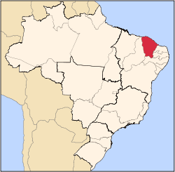
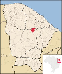 Location in the State of Ceará | |
 | |
| Coordinates: 04°50′36″S 39°08′28″W | |
| Country | |
| Region | Northeast |
| State | |
| Founded | March 27, 1992 |
| Government | |
| • Mayor | Jose Antonio Rodrigues Mendes (Dé)(PSDB) |
| Area | |
| • Total | 815.759 km2 (314.966 sq mi) |
| Elevation | 243 m (797 ft) |
| Population (2008)[1] | |
| • Total | 13,316 |
| • Density | 15.8/km2 (41/sq mi) |
| Time zone | UTC-3 (UTC-3) |
| • Summer (DST) | UTC-2 (UTC-2) |
| HDI (2000) | 0.561 – medium |
Neighborhoods
List of neighborhoods in Choró:
- Barbada - Farm
- Barreira Branca – Small Farm
- Boa Vista - Farm
- Caicarinha - District
- Centro - Seat
- Feijão - Settlement
- Maravilha - District
- Monte Castelo - District
- Olho D'agua – Small Farm
- Piemonte - Settlement
- Poço do Barro - Farm
- Santa Rita - Village
- São João - Settlement
- São José- Farm
- São Mateus – Small Farm
- Serra da Palha
- Serra do Teixeira
- Teodosio - Farm
gollark: You can post images in <#424394851170385923> I think.
gollark: They would probably blacklist you eventually.
gollark: Obviously, the solution is to work out how to make it give you every listing in order of creation date (descending), then just do that repeatedly to harvest all listings, then filter unwanted ones out however you want.
gollark: Maybe the number of results is just a lie? Google's apparently is.
gollark: Weird.
References
- "Estimativas da população para 1º de julho de 2008" (PDF). Instituto Brasileiro de Geografia e Estatística (IBGE). 29 August 2008. Archived from the original (PDF) on 8 September 2008. Retrieved 5 September 2008.
This article is issued from Wikipedia. The text is licensed under Creative Commons - Attribution - Sharealike. Additional terms may apply for the media files.