Chintoor
Chintoor or Chinturu is a mandal in East Godavari district of the Indian state Andhra Pradesh. It is located in Rampachodavaram revenue division.
Chintoor Chinturu | |
|---|---|
Mandal | |
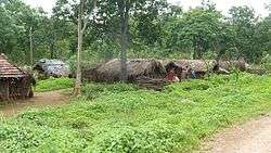 Settlements near Chintoor | |
.svg.png) Chintoor Location in Andhra Pradesh, India  Chintoor Chintoor (India) | |
| Coordinates: 17.75°N 81.4°E | |
| Country | |
| State | Andhra Pradesh |
| District | East Godavari |
| Elevation | 35 m (115 ft) |
| Languages | |
| • Official | Telugu |
| • Indigenous | Koya |
| Time zone | UTC+5:30 (IST) |
| Vehicle registration | AP |
| Climate | hot (Köppen) |
Geography
Chinturu has an average elevation of 35 metres (118 ft). Geo Coordinates: 17°44'N 81°23'E. Chinturu is situated besides river Sabari. Sabari is sub river of Godavari river.
gollark: The what?
gollark: The Moon is pretty big and the beam would diverge.
gollark: The crater might even be livable in a hundred years, it's fine.
gollark: How would that work? In my experience crystal growing mostly involves waiting around. Just show "here's a solution" and some of the in-the-middle bits, and then some crystals?
gollark: I mean, people already talk about them a bit, just not in a dedicated channel.
References
This article is issued from Wikipedia. The text is licensed under Creative Commons - Attribution - Sharealike. Additional terms may apply for the media files.