Chhetrapa
Kshetrapa (Nepali:क्षेत्रपा,) is a village development committee of north-eastern Nepal. At the time of the National Population and Housing Census 2011 it had a population of 2447(1116 Male & 1331 female) people living in 580 individual households.[1] There is one high school named Shree Kshetrawati Higher Secondary School at Peepal Daada, Majhgaun. Through the middle of the village Namdu Jugu road is under construction. Seasonal Bus service is available from Kathmandu but around 170 km ride takes 6 to 8 hours due to narrow, winding roads. Majority of the people staying here from aged back is Jirel then Chettris & Newaar. The original trailhead actually began at Kathmandu of all early Everest expeditions the "classic route to Everest", on the summit—passed through Kshetrapa as alternate to the other route which connect at yarsa, Kavre through Kiratichhap heading to Jiri.[2]
Template:Grammar\date=August 2020
Kshetrapa Chhetrapa | |
|---|---|
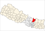
 Kshetrapa Location of Kshetrapa Village of Nepal. | |
| Coordinates: 27.67°N 86.15°E | |
| Country | |
| Zone | Janakpur Zone |
| District | Dolakha District |
| Population (2011) | |
| • Total | 2,447 |
| Time zone | UTC+5:45 (Nepal Time) |
Villages
The following is a list of areas or subvillages cities of Kshetrapa Village Development Committee.
References
- "Archived copy" (PDF). Archived from the original (PDF) on 2013-01-24. Retrieved 2012-11-01.CS1 maint: archived copy as title (link)
- http://www.un.org.np/maps/district-constituency-maps/central/Dolakha.pdf UN map of the municipalities of Dolakha District
External links