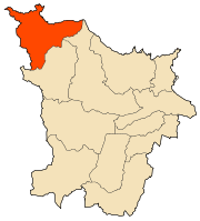
Chetaïbi District
The Chataibi district is an Algerian administrative district in the Annaba province. Its chief town is located on the eponymous town of Chetaïbi .[1][2]
Chataibi District | |
|---|---|
 | |
| Coordinates: | |
| Country | |
| Province | Annaba Province |
| County seat | Chetaïbi |
| Area | |
| • Total | 52 sq mi (134 km2) |
| Population (2008) | |
| • Total | 8,035 |
| • Density | 200/sq mi (60/km2) |
| Time zone | UTC+1 (CET) |
Communes
The daira is composed of only one commune: Chetaïbi.
gollark: Hmm, actually looking at my projects list has reminded me, I should fix my `stack-overflow-import` fork somehow.
gollark: I don't, actually.
gollark: (those are on pastebin anyway)
gollark: And here I was thinking they might want to be forewarned of any mildly evil project I made or something...
gollark: That prompted me to check my stuff, and hydraz/matheus followed me on github for some reason? How odd.
References
- "Chetaibi District". OpenStreetMap. OpenStreetMap. Retrieved 6 May 2018.
- "Chetaibi". postboxmap. Retrieved 6 May 2018.
.svg.png)
This article is issued from Wikipedia. The text is licensed under Creative Commons - Attribution - Sharealike. Additional terms may apply for the media files.