Chemillé-sur-Dême
Chemillé-sur-Dême is a commune in the Indre-et-Loire department in central France.
Chemillé-sur-Dême | |
|---|---|
Location of Chemillé-sur-Dême 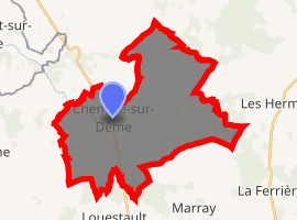
| |
 Chemillé-sur-Dême  Chemillé-sur-Dême | |
| Coordinates: 47°39′34″N 0°38′57″E | |
| Country | France |
| Region | Centre-Val de Loire |
| Department | Indre-et-Loire |
| Arrondissement | Chinon |
| Canton | Château-Renault |
| Government | |
| • Mayor (2008–2014) | Éloi Canon |
| Area 1 | 33.54 km2 (12.95 sq mi) |
| Population (2017-01-01)[1] | 719 |
| • Density | 21/km2 (56/sq mi) |
| Time zone | UTC+01:00 (CET) |
| • Summer (DST) | UTC+02:00 (CEST) |
| INSEE/Postal code | 37068 /37370 |
| Elevation | 75–164 m (246–538 ft) |
| 1 French Land Register data, which excludes lakes, ponds, glaciers > 1 km2 (0.386 sq mi or 247 acres) and river estuaries. | |
Population
| Year | Pop. | ±% |
|---|---|---|
| 1793 | 1,330 | — |
| 1800 | 1,371 | +3.1% |
| 1806 | 1,505 | +9.8% |
| 1821 | 1,527 | +1.5% |
| 1831 | 1,314 | −13.9% |
| 1836 | 1,207 | −8.1% |
| 1841 | 1,110 | −8.0% |
| 1846 | 1,077 | −3.0% |
| 1851 | 1,103 | +2.4% |
| 1856 | 1,145 | +3.8% |
| 1861 | 1,153 | +0.7% |
| 1866 | 1,084 | −6.0% |
| 1872 | 1,087 | +0.3% |
| 1876 | 1,046 | −3.8% |
| 1881 | 1,064 | +1.7% |
| 1886 | 1,092 | +2.6% |
| 1891 | 1,062 | −2.7% |
| 1896 | 1,092 | +2.8% |
| 1901 | 1,082 | −0.9% |
| 1906 | 1,028 | −5.0% |
| 1911 | 1,008 | −1.9% |
| 1921 | 925 | −8.2% |
| 1926 | 923 | −0.2% |
| 1931 | 945 | +2.4% |
| 1936 | 929 | −1.7% |
| 1946 | 957 | +3.0% |
| 1954 | 940 | −1.8% |
| 1962 | 880 | −6.4% |
| 1968 | 800 | −9.1% |
| 1975 | 677 | −15.4% |
| 1982 | 644 | −4.9% |
| 1990 | 585 | −9.2% |
| 1999 | 575 | −1.7% |
| 2006 | 648 | +12.7% |
| 2009 | 672 | +3.7% |
gollark: You feed them events via `coroutine.resume`, and once you do that they run a bit then yield.
gollark: <@251504001827340288> Actually, coroutines are not `buffered`.
gollark: Okay!
gollark: Do you have something against potatOS?
gollark: Yes, I Used One Before™.
References
- "Populations légales 2017". INSEE. Retrieved 6 January 2020.
| Wikimedia Commons has media related to Chemillé-sur-Dême. |
| Authority control |
|
|---|
This article is issued from Wikipedia. The text is licensed under Creative Commons - Attribution - Sharealike. Additional terms may apply for the media files.