Chamberlain USFS Airport
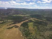
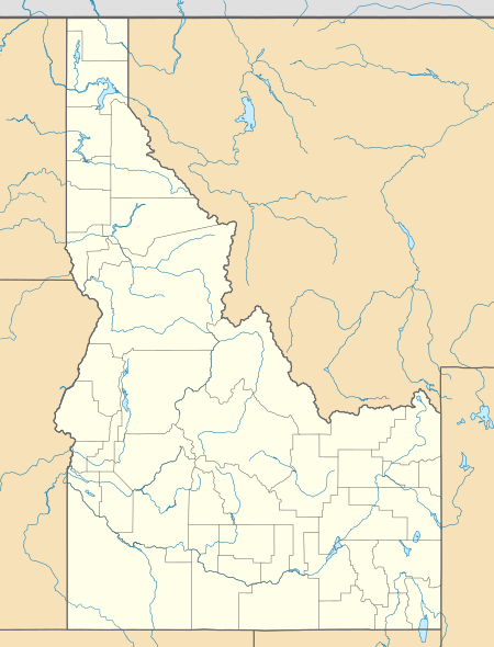
Chamberlain USFS Airport (FAA LID: U79) is a public use airport located at Chamberlain Guard Station, in Idaho County, Idaho, United States. The airport is owned by the U.S. Forest Service.[1] It is located near Chamberlain Creek[2] in the Payette National Forest.
Chamberlain USFS Airport | |||||||||||||||
|---|---|---|---|---|---|---|---|---|---|---|---|---|---|---|---|
 | |||||||||||||||
| Summary | |||||||||||||||
| Airport type | Public | ||||||||||||||
| Owner | U.S. Forest Service | ||||||||||||||
| Serves | Chamberlain Guard Station, Idaho | ||||||||||||||
| Elevation AMSL | 5,765 ft / 1,757 m | ||||||||||||||
| Coordinates | 45°22′45″N 115°11′48″W | ||||||||||||||
| Map | |||||||||||||||
 Chamberlain USFS Airport | |||||||||||||||
| Runways | |||||||||||||||
| |||||||||||||||
| Statistics (2009) | |||||||||||||||
| |||||||||||||||
Facilities and aircraft
Chamberlain USFS Airport covers an area of 55 acres (22 ha) at an elevation of 5,765 feet (1,757 m) above mean sea level. It has two runways: 7/25 is 4,100 by 200 feet (1,250 x 61 m) with a turf and dirt surface and 15/33 is 2,700 by 140 feet (823 x 43 m) with a turf surface. For the 12-month period ending September 24, 2009, the airport had 4,000 aircraft operations, an average of 10 per day: 62.5% general aviation and 37.5% air taxi.[1]
gollark: Two IIRC, for WiFi and the cellular modem.
gollark: If you disconnect the network it gives you the offline account option IIRC, but it's annoying and stupid.
gollark: I've seen graphite thermal pad things. Maybe that would work.
gollark: *try and calculate something**accidentally fall over*
gollark: I wonder what calculators actually designed in this century could be like. Probably just somewhat specialized tablets with low-powered CPUs and higher battery life.
References
- FAA Airport Master Record for U79 (Form 5010 PDF). Federal Aviation Administration. Effective 29 July 2010.
- "Chamberlain Basin USFS (U79)". Airport Facility Directory. Idaho Transportation Department. Archived from the original on 29 November 2010. Retrieved 26 September 2010.
External links
- Topo map as of 1 July 1974 from USGS The National Map
- Resources for this airport:
- FAA airport information for U79
- AirNav airport information for U79
- FlightAware airport information and live flight tracker
- SkyVector aeronautical chart for U79
| Wikimedia Commons has media related to Chamberlain USFS Airport. |
This article is issued from Wikipedia. The text is licensed under Creative Commons - Attribution - Sharealike. Additional terms may apply for the media files.