Centro (Málaga)
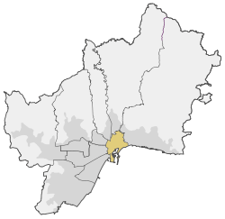
Centro (Spanish for Centre), also known as District 1 and Málaga-Centro, is one of the 11 districts of the city of Málaga, Spain.
Centro | |
|---|---|
 | |
| Country | |
| Aut. community | |
| Municipality | |
| Area | |
| • Total | 5.87 km2 (2.27 sq mi) |
| Population | 84,988 |
| • Density | 14,478.36/km2 (37,498.8/sq mi) |
| Málaga district number | 1 |
| Address of council | Calle La Merced 1, 29014 |
It comprises de following wards (barrios): Barcenillas, Camino del Colmenar, Campos Elíseos, Cañada de los Ingleses, Capuchinos, Centro Histórico, Conde de Ureña, Cristo de la Epidemia, El Bulto, El Ejido, El Molinillo, Ensanche Centro, Explanada de la Estación, La Aurora, La Goleta, La Manía, La Merced, La Trinidad, La Victoria, Lagunillas, Los Antonios, Mármoles, Monte de Gibralfaro, Olletas, Parque Ayala, Perchel Norte, Perchel Sur, Pinares de Olletas, Plaza de Toros Vieja, Polígono Alameda, R.E.N.F.E., San Miguel, Santa Amalia, Segalerva, Seminario, Sierra Blanquilla y Ventaja Alta.[1]
Gallery
- El Parque

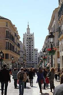 Larios Street
 Paseo de los Curas
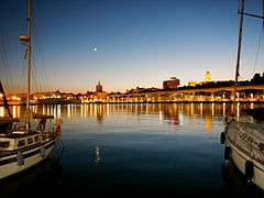 Port of Málaga
 Plaza de la Merced
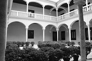
 CAC Málaga
gollark: It froze at 51% this time.
gollark: It takes real dedication to cause Jav'aa errors.
gollark: Cool OS!
gollark: It's stuck at 55%.
gollark: *runs inside PotatOS*
References
- Official wards map of district 1 Archived January 6, 2011, at the Wayback Machine
External links
This article is issued from Wikipedia. The text is licensed under Creative Commons - Attribution - Sharealike. Additional terms may apply for the media files.