Cartography of the United States
The Cartography of the United States is the history of surveying and creation of maps of the United States. Maps of the New World had been produced since the 19th century. The history of cartography of the United States begins in the 18th century, after the declared independence of the thirteen original colonies on July 4, 1776, during the American Revolutionary War (1775-1783). Later, Samuel Augustus Mitchell published a map of the United States in 1867. The National Program for Topographic Mapping was initiated in 2001 by the United States Geological Survey.
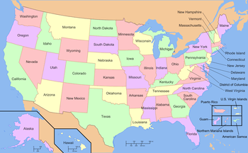
Map of the United States with state and territory names
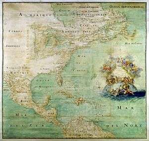
1681 map of South America
See also
- Geography of the United States
- Territorial evolution of the United States
- United States National Grid
- United States territorial acquisitions
References
Further reading
- S. Max Edelson, The New Map of Empire: How Britain Imagined America Before Independence. Cambridge, Massachusetts: Harvard University Press, 2017
- Susan Schulten, Mapping the Nation: History and Cartography in Nineteenth-Century America. Chicago, Illinois: University of Chicago Press, 2012
External links

- 125 Years of Topographic Mapping
This article is issued from Wikipedia. The text is licensed under Creative Commons - Attribution - Sharealike. Additional terms may apply for the media files.