Capitol, Montana
Capitol is a ghost town in Carter County, Montana, United States.
Geography
Capitol is located at 45.43611°N 104.065°W. Its elevation is 3,168 ft (966 m).
Capitol was named after Capitol Rock, a prominent landmark in the nearby Long Pine Hills. Capitol is located on the Little Missouri River and close to the South Dakota border.
Town
Capitol is a ghost town with two remaining buildings.
Post Office
Capitol had a post office from 1891–1982. Residents who have a Capitol address receive their mail from the neighboring post office of Camp Crook, South Dakota.
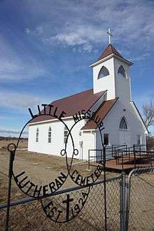
Church
A church named 'Little Missouri Lutheran Church' is located near Capitol. The congregation celebrated its 125th anniversary in 2014. The church was established 5 months before Montana became a state.
Cemeteries
Capitol Cemetery is located northeast of town on Little Missouri Road. Little Missouri Lutheran Church Cemetery located behind current Church location.
Population
As of 2017 the population of Capitol is 3.
Municipalities and communities of Carter County, Montana, United States | ||
|---|---|---|
| Town | 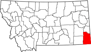 Carter County map | |
| CDP | ||
| Other unincorporated communities | ||
| Indian reservation | ||
| Footnotes | ‡This populated place also has portions in an adjacent county or counties | |