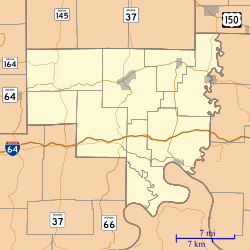
Cape Sandy, Indiana
Cape Sandy is an unincorporated community in Ohio Township, Crawford County, Indiana.
Cape Sandy | |
|---|---|
 Cape Sandy | |
| Coordinates: 38°09′03″N 86°22′15″W | |
| Country | United States |
| State | Indiana |
| County | Crawford |
| Township | Ohio |
| Elevation | 741 ft (226 m) |
| ZIP code | 47137 |
| FIPS code | 18-10180[1] |
| GNIS feature ID | 432118[2] |
History
A post office was established at Cape Sandy in 1877, and remained in operation until it was discontinued in 1965.[3]
Geography
Cape Sandy is located at 38°09′03″N 86°22′15″W.
gollark: ?
gollark: Okay, so, different idea: core logic in Rust, maybe use an ECS or something, and see if I can have Lua-based scripting?
gollark: oh dear.
gollark: If I was using Rust, actually, I could make the protocol into tightly packed bincode and thus save on network IO.
gollark: Hmm, wow, apparently the combination of inefficient EWO protocol and high concurrent client count means that under heavy load even nginx uses 5% CPU.
References
- "U.S. Census website". United States Census Bureau. Retrieved 2008-01-31.
- "Cape Sandy, Indiana". Geographic Names Information System. United States Geological Survey. Retrieved 2009-10-10.
- "Crawford County". Jim Forte Postal History. Archived from the original on 3 September 2014. Retrieved 30 August 2014.
See also
- List of cities and towns along the Ohio River
This article is issued from Wikipedia. The text is licensed under Creative Commons - Attribution - Sharealike. Additional terms may apply for the media files.