Canefield Airport
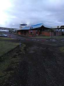
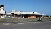
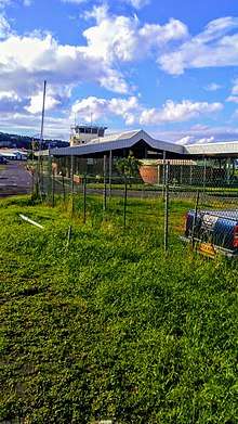
Canefield Airport (IATA: DCF, ICAO: TDCF) is an airport on the west coast of the island nation of Dominica. It is 3 miles (5 km) north of Roseau, the capital. Construction began in early 1979 with British funding, shortly after Dominica's independence.[4] It is about one hour away from the second largest city Portsmouth. It is one of only two airports in the island nation of Dominica, the other being Douglas-Charles Airport.


Canefield Airport | |||||||||||
|---|---|---|---|---|---|---|---|---|---|---|---|
 View of the Canefield Airport | |||||||||||
| Summary | |||||||||||
| Airport type | Public | ||||||||||
| Owner | Government of Dominica | ||||||||||
| Operator | Dominica Air & Sea Ports Authority | ||||||||||
| Serves | Roseau, Dominica | ||||||||||
| Elevation AMSL | 13 ft / 4 m | ||||||||||
| Coordinates | 15°20′12″N 61°23′32″W | ||||||||||
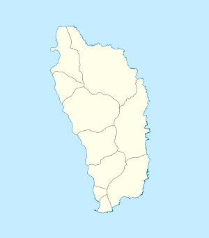
| Map | |||||||||||
 DCF Location in Dominica | |||||||||||
| Runways | |||||||||||
| |||||||||||
Runway
The Canefield Airport has one runway 01/19, which measures 3130 feet (954 metres). Runway 01 has a 500-foot displaced threshold. There is mountainous terrain to the east, and rising terrain north and south, with the Caribbean sea to the west. This is without a doubt one of the more challenging airfields to land at in the Caribbean with strong crosswinds often present off the mountains and limited stopping distance available. Commercial operations required a specific pilot check to be able to fly in and out with often only the more experienced pilots at the controls for take off and landing.
Traffic
Most of these flights operate with turboprop and piston aircraft such as the De Havilland Canada DHC-6 Twin Otter, Beechcraft King Air and the Aero Commander 500, Cessna aircraft, Freighters, and private aircraft.
Airlines and destinations
Passenger
The following airlines operate passenger flights to the Canefield Airport:
| Airlines | Destinations |
|---|---|
| Air Antilles | Fort-de-France, Pointe-à-Pitre[5] |
| Airawak | Fort-de-France |
| Anguilla Air Services[6] | Seasonal: Anguilla, Antigua, Saint Barthélemy, Saint Kitts, St. Maarten |
| Coastal Air | Saint Croix, St. Maarten Seasonal: Anguilla, Nevis, St. Eustatius |
| Express Carrier LLC | Anguilla, Saint Croix, St. Thomas Seasonal: Antigua, Nevis, Saint Kitts, Tortola |
| Fly Montserrat | Seasonal: Montserrat |
| Winair | Seasonal: St. Maarten, Antigua |
Charter
The following airlines operate chartered flights into the Canefield Airport
| Airlines | Destinations |
|---|---|
| Fly BVI Ltd | Beef Island |
| Caribbean Helicopters | Antigua |
| Island Birds | San Juan, Antigua |
| St Barth Commuter | Saint Barthélemy, Fort-de-France, Pointe-à-Pitre, Saint Martin |
| SXM Airways | St. Maarten |
| Trans Anguilla Airways | Anguilla |
Cargo
| Airlines | Destinations |
|---|---|
| Coastal Air | St. Croix |
| Express Carrier LLC | St. Thomas |
| DHL | Antigua |
Statistics
The busiest routes year round to the Canefield Airport.
| Rank | City | Top Carriers |
|---|---|---|
| 1 | Christiansted, St. Croix | Coastal Air, Express Carrier LLC |
| 2 | Charlotte Amalie, St. Thomas | Express Carrier LLC |
| 3 | Phillipsburg, St. Maarten | Anguilla Air Services, Coastal Air |
Incidents and accidents
- On Tuesday, March 1, 2011 a Rockwell Shrike Commander aircraft right main gear blew and the aircraft veered off the runway to the right. There were no injuries and this mishap is still unexplained.[7]
- On Thursday, February 16, 2012 a Cessna 402 made an emergency landing. It landed without further incident.[8]
- On Thursday, February 27, 2014 a Cessna 404 aircraft ran off the runway, suffered damage to the left wing.[9]
- On Sunday, February 8, 2015 a private Cessna 404 aircraft coming from Venezuela ran off the runway, suffered extensive damage...[10]
- On Wednesday, February 7, 2018 a Rockwell Shrike Commander aircraft upon landing suffered nose gear failure.[11]
References
- Airport information for Canefield Airport at Great Circle Mapper.
- "Canfield Airport". SkyVector. Retrieved 22 June 2018.
- "Canefield Airport". Bing Maps. Microsoft. Retrieved 22 June 2018.
- United Press International (UPI) (January 3, 1979). "New Dominica airport". The Hour. Norwalk, Connecticut. p. 18. Retrieved December 2, 2010.
- Liu, Jim. "Air Antilles schedules new sectors in W19". Routesonline. Retrieved 20 August 2019.
- http://www.anguillaairservices.com
- http://dominicanewsonline.com/news/homepage/news/accidents-tragedy/breaking-news-plane-crash-at-canefield-airport-2/
- http://dominicanewsonline.com/news/homepage/news/accidents-tragedy/plane-mishap-at-canefield-airport/
- https://www.dominicavibes.dm/news-122909/
- http://dominicanewsonline.com/news/homepage/news/accidents-tragedy/update-plane-mishap-at-canefield/
- http://dominicanewsonline.com/news/homepage/news/general/update-eccaa-to-investigate-canefield-airport-plane-accident/