Campo Arañuelo
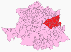
Campo Arañuelo is a comarca in Cáceres, Extremadura, Spain. It contains the municipalities of Almaraz, Belvís de Monroy, Berrocalejo, Bohonal de Ibor, Casas de Miravete, Casatejada, El Gordo, Higuera de Albalat, Majadas, Mesas de Ibor, Millanes, Navalmoral de la Mata, Peraleda de la Mata, Romangordo, Rosalejo, Saucedilla, Serrejón, Talayuela, Tiétar, Toril, Valdecañas de Tajo, Valdehúncar.[1] Notable for the Dolmen de Guadalperal, the "Spanish Stonehenge".
Campo Arañuelo | |
|---|---|
 | |
| Coordinates: 39°50′46″N 5°36′28″W | |
| Country | Spain |
| Autonomous community | Extremadura |
| Province | Cáceres |
| Area | |
| • Total | 1,491 km2 (576 sq mi) |
| Population (2008) | |
| • Total | 37,644 |
| • Density | 25/km2 (65/sq mi) |
Sources
- La Gaceta del Arañuelo - Las noticias del Campo Arañuelo
- Web oficial de la comarca del Campo Arañuelo
- Web oficial de la Mancomunidad de Municipios del Campo Arañuelo
- Noticias del Campo Arañuelo en NavalmoralDigital.com
gollark: Do you mean the discussion of baidicoot being banned, or...?
gollark: * take quite long
gollark: I'm working on it. It may be quite long.
gollark: Probably the jwinslow thing?
gollark: If you specify those, I can redact them.
References
- "Campo Aranuelo". www.geopostcodes.com. Retrieved 2017-12-29.
Comarcas of Extremadura | ||
|---|---|---|
| ||
This article is issued from Wikipedia. The text is licensed under Creative Commons - Attribution - Sharealike. Additional terms may apply for the media files.