Calumet, Arizona
Calumet is a populated place situated in Cochise County, Arizona.[2] It has an estimated elevation of 3,970 feet (1,210 m) above sea level.[1]
Calumet, Arizona | |
|---|---|
Populated place | |
 Calumet, Arizona Location within the state of Arizona  Calumet, Arizona Calumet, Arizona (the United States) | |
| Coordinates: 31°21′15″N 109°36′27″W | |
| Country | United States |
| State | Arizona |
| County | Cochise |
| Elevation | 3,970 ft (1,210 m) |
| Time zone | UTC-7 (Mountain (MST)) |
| • Summer (DST) | UTC-7 (MST) |
| Area code(s) | 520 |
| FIPS code | 04-09130 |
| GNIS feature ID | 24341 |
It was named after the nearby Calumet mine operated by the Calumet and Arizona Mining Company.[3]
References
- "Feature Detail Report for: Calumet". Geographic Names Information System. United States Geological Survey.
- "Calumet (in Cochise County, AZ) Populated Place Profile". AZ Hometown Locator. Retrieved October 31, 2016.
- Barnes, Will Croft (1988). Arizona Place Names. University of Arizona Press. ISBN 978-0-8165-1074-0.
Municipalities and communities of Cochise County, Arizona, United States | ||
|---|---|---|
| Cities | 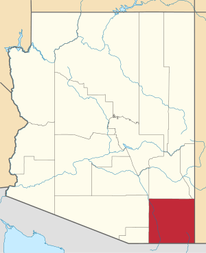 | |
| Towns | ||
| CDPs | ||
| Populated places |
| |
| Ghost towns | ||
This article is issued from Wikipedia. The text is licensed under Creative Commons - Attribution - Sharealike. Additional terms may apply for the media files.