Cáchira
Cáchira is a Colombian municipality located in the department of Norte de Santander. The urban centre is situated at an altitude of 2,025 metres (6,644 ft) in the Eastern Ranges of the Colombian Andes.[1]
Cáchira | |
|---|---|
Municipality and town | |
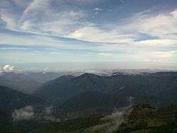 View of Cáchira and surrounding mountains | |
.svg.png) Flag | |
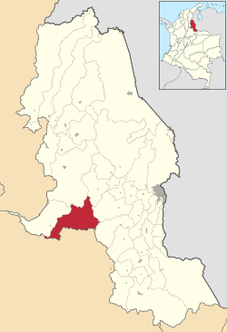 Location of Cáchira in Norte de Santander | |
 Cáchira Location of Cáchira in Colombia | |
| Coordinates: 7°45′N 73°10′W | |
| Country | |
| Department | Norte de Santander Department |
| Subregion | Western |
| Founded | 7 March 1811 |
| Government | |
| • Mayor | Henry Augusto Reyes Acevedo (2016-2019) |
| Area | |
| • Municipality and town | 605.94 km2 (233.95 sq mi) |
| Elevation | 2,025 m (6,644 ft) |
| Population (2015) | |
| • Municipality and town | 10,970 |
| • Density | 18/km2 (47/sq mi) |
| • Urban | 1,700 |
| Time zone | UTC-5 (Colombia Standard Time) |
| Climate | Cfb |
| Website | Official website |
Gallery
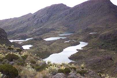 Siete Lagunas ("Seven Lakes") on Cáchira's páramo
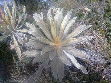 Espeletia schultzii on Cáchira's páramo
gollark: How do I use this exactly?
gollark: CPU use is basically zero.
gollark: They point to the same IP.
gollark: Well, either work, yes.
gollark: * osmarks.net
References
| Wikimedia Commons has media related to Cáchira. |
- (in Spanish) Official website Cáchira
This article is issued from Wikipedia. The text is licensed under Creative Commons - Attribution - Sharealike. Additional terms may apply for the media files.