Cérou
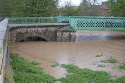
The Cérou (French: le Cérou) is an 87.4 km (54.3 mi) long river in the Aveyron and Tarn departments in southern France. Its source is at Saint-Jean-Delnous, 1.8 km (1.1 mi) northwest of the village. It flows generally west-northwest. It is a left tributary of the Aveyron, into which it flows at Milhars, 1.4 km (0.87 mi) north of the village.
| Cérou | |
|---|---|
 | |
| Location | |
| Country | France |
| Physical characteristics | |
| Source | |
| • location | near Saint-Jean-Delnous |
| • coordinates | 44°03′21″N 02°28′33″E |
| • elevation | 530 m (1,740 ft) |
| Mouth | |
• location | Aveyron |
• coordinates | 44°08′21″N 01°52′32″E |
• elevation | 128 m (420 ft) |
| Length | 87.4 km (54.3 mi) |
| Basin size | 503 km2 (194 sq mi) |
| Discharge | |
| • average | 4.13 m3/s (146 cu ft/s) |
| Basin features | |
| Progression | Aveyron→ Tarn→ Garonne→ Gironde estuary→ Atlantic Ocean |
Departments and communes along its course
It flows generally west through the following departments and communes, ordered from source to mouth:
- Aveyron: Saint-Jean-Delnous, Lédergues
- Tarn: Lédas-et-Penthiès, Lacapelle-Pinet, Padiès, Crespin, Andouque, Saint-Jean-de-Marcel, Valderiès, Rosières, Carmaux, Saint-Benoît-de-Carmaux, Monestiés, Le Ségur, Salles, Saint-Marcel-Campes, Cordes-sur-Ciel, Les Cabannes, Mouzieys-Panens, Vindrac-Alayrac, Labarthe-Bleys, Marnaves, Milhars
Tributaries
The Farruel (12.5 km), the Boutescure (15.4 km), the Céroc (17.6 km), the Candou, the Céret (28.5 km), the Zère, the Aymer (12,2 km), and the Bonnan.
Notes
- This article is based on the equivalent article from the French Wikipedia, consulted on January 27th 2009.
gollark: You could actually *see* what a particular set of policies does.
gollark: Sure it would, ignoring the obvious implementation issues.
gollark: It wouldn't be ethical to run an experimental country with non-volunteers and good luck getting volunteers! (Also, the opt in ness would change the outcomes)
gollark: We could actually empirically test economics and politics and not just assume things online!
gollark: It's totally impractical to run it, but it would be so great.
This article is issued from Wikipedia. The text is licensed under Creative Commons - Attribution - Sharealike. Additional terms may apply for the media files.