Butts, Missouri
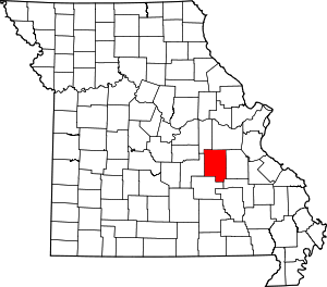
Butts is an unincorporated community in eastern Crawford County, in the U.S. state of Missouri.[1] The community is on the north side of Henpeck Hollow about one-half mile east of Courtois Creek.[2] Access is via a county road from Missouri Route 8, approximately five miles east of Elayer. The location is within the Mark Twain National Forest and a campground is located on the Courtois River to the west of the site.[3]
History
A post office called Butts was established in 1902, and remained in operation until 1954.[4] The community has the name of the local Butts family.[5]
gollark: Did you *read* the code?
gollark: No.
gollark: Well, at all.
gollark: <@319753218592866315> <@!491174779278065689> Why does your thing not truncate messages properly?
gollark: ???
References
- U.S. Geological Survey Geographic Names Information System: Butts, Missouri
- Huzzah, Missouri, 7.5 Minute Topographic Quadrangle, USGS, 1978 (1985 rev.)
- Missouri Atlas & Gazetteer, DeLorme, 1998, First edition, p. 47 ISBN 0-89933-224-2
- "Post Offices". Jim Forte Postal History. Archived from the original on 6 March 2016. Retrieved 24 September 2016.
- "Crawford County Place Names, 1928–1945 (archived)". The State Historical Society of Missouri. Archived from the original on 24 June 2016. Retrieved 24 September 2016.CS1 maint: BOT: original-url status unknown (link)
This article is issued from Wikipedia. The text is licensed under Creative Commons - Attribution - Sharealike. Additional terms may apply for the media files.
