Bush Creek (New Hope River tributary)
Bush Creek is a 5.76 mi (9.27 km) long 3rd order tributary to the New Hope River in North Carolina. Bush Creek joins the New Hope River within the B. Everett Jordan Lake Reservoir.
| Bush Creek Tributary to New Hope River | |
|---|---|
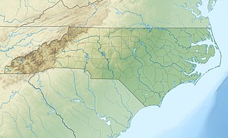
 Location of Bush Creek mouth  Bush Creek (New Hope River tributary) (the United States) | |
| Location | |
| Country | United States |
| State | North Carolina |
| County | Chatham |
| Physical characteristics | |
| Source | Pokeberry Creek divide |
| • location | Farrington Village, North Carolina |
| • coordinates | 35°47′48″N 079°05′21″W[1] |
| • elevation | 430 ft (130 m)[2] |
| Mouth | New Hope River |
• location | B. Everett Jordan Lake |
• coordinates | 35°47′33″N 079°00′53″W[1] |
• elevation | 216 ft (66 m)[2] |
| Length | 5.76 mi (9.27 km)[3] |
| Basin size | 12.09 square miles (31.3 km2)[4] |
| Discharge | |
| • location | New Hope River (B. Everett Jordan Lake) |
| • average | 14.56 cu ft/s (0.412 m3/s) at mouth with New Hope River[4] |
| Basin features | |
| Progression | northeast then southeast |
| River system | Haw River |
| Tributaries | |
| • left | Herndon Creek Overcup Creek |
| Waterbodies | B. Everett Jordan Lake |
| Bridges | Millcroft Road, Langdon Court, Big Woods Road |
Course
Bush Creek rises on the Pokeberry Creek divide in Farrington Village, North Carolina. Bush Creek then flows northeast and then turns southeast to meet New Hope River in the B. Everett Jordan Lake Reservoir in Chatham County.[2]
.jpg)
Course of Bush Creek (New Hope River tributary)
Watershed
Bush Creek drains 12.09 square miles (31.3 km2) of area, receives about 47.3 in/year of precipitation, has a topographic wetness index of 405.13, and has an average water temperature of 15.07 °C.[4] The watershed is 52% forested.[4]
.jpg)
Watershed of Bush Creek (New Hope River tributary)
gollark: Possibly, actually.
gollark: It's still monkeyed...
gollark: .
gollark: @s become monkey emoji
gollark: Hey <@278889690596376576> This DIY yempoking is great (though probably doesn't work).
References
- "GNIS Detail - Bush Creek". geonames.usgs.gov. US Geological Survey. Retrieved 3 December 2019.
- "New Hope Creek Topo Map, Chatham County NC (Green Level Area)". TopoZone. Locality, LLC. Retrieved 2 December 2019.
- "ArcGIS Web Application". epa.maps.arcgis.com. US EPA. Retrieved 2 December 2019.
- "Bush Creek Watershed Report". Waters Geoviewer. US EPA. Retrieved 3 December 2019.
This article is issued from Wikipedia. The text is licensed under Creative Commons - Attribution - Sharealike. Additional terms may apply for the media files.