Pokeberry Creek (Haw River tributary)
Pokeberry Creek is a 7.82 mi (12.59 km) long 3rd order tributary to the Haw River in Chatham County, North Carolina. This creek is one of two streams in the United States named Pokeberry Creek. The other is in Warrick County, Indiana.
| Pokeberry Creek Tributary to Haw River | |
|---|---|
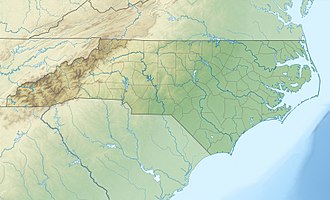
 Location of Pokeberry Creek mouth  Pokeberry Creek (Haw River tributary) (the United States) | |
| Location | |
| Country | United States |
| State | North Carolina |
| County | Chatham |
| Physical characteristics | |
| Source | divide between Pokeberry Creek and Morgan Creek |
| • location | about 5 miles southwest of Chapel Hill, North Carolina |
| • coordinates | 35°50′28″N 079°07′26″W[1] |
| • elevation | 552 ft (168 m)[2] |
| Mouth | Haw River |
• location | about 1 mile southeast of Bynum, North Carolina |
• coordinates | 35°45′48″N 079°07′52″W[1] |
• elevation | 290 ft (88 m)[2] |
| Length | 7.82 mi (12.59 km)[3] |
| Basin size | 12.81 square miles (33.2 km2)[4] |
| Discharge | |
| • location | Haw River |
| • average | 15.62 cu ft/s (0.442 m3/s) at mouth with Haw River[4] |
| Basin features | |
| Progression | southwest |
| River system | Haw River |
| Tributaries | |
| • left | Ward Branch |
| • right | unnamed tributaries |
| Bridges | Great Ridge Parkway, Catulio Run, Andrews Store Road, Morris Road, US 15, Bynum Ridge Road |
Course
Pokeberry Creek rises about 5 miles southwest of Chapel Hill, North Carolina in Chatham County and then flows southwest to the Haw River just downstream of Bynum.[2]
Watershed
Pokeberry Creek drains 12.81 square miles (33.2 km2) of area, receives about 47.4 in/year of precipitation, and has a wetness index of 395.85 and is about 71% forested.[4]
gollark: i386 isn't real.
gollark: There is no longer the ocamulous bootstrap compiler.
gollark: rustc can totally self-compile. It can *only* self-compile.
gollark: ... no, I am to run my website and none else.
gollark: Just imagine I have it, that's basically as good.
References
- "GNIS Detail - Pokeberry Creek". geonames.usgs.gov. US Geological Survey. Retrieved 28 September 2019.
- "Pokeberry Creek Topo Map, Chatham County NC (Bynum Area)". TopoZone. Locality, LLC. Retrieved 28 September 2019.
- "ArcGIS Web Application". epa.maps.arcgis.com. US EPA. Retrieved 28 September 2019.
- "Pokeberry Creek Watershed Report". Waters Geoviewer. US EPA. Retrieved 28 September 2019.
External links
This article is issued from Wikipedia. The text is licensed under Creative Commons - Attribution - Sharealike. Additional terms may apply for the media files.