Burnley railway station
Burnley railway station is located on the Lilydale, Belgrave, Alamein and Glen Waverley lines in Victoria, Australia, and serves the inner eastern Melbourne suburb of Burnley. The station opened as Burnley Street on 1 May 1880, and was renamed Burnley on 1 September 1882.[1]
Burnley | |||||||||||||||||||||||
|---|---|---|---|---|---|---|---|---|---|---|---|---|---|---|---|---|---|---|---|---|---|---|---|
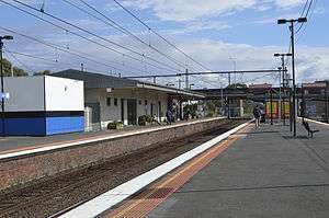
 View from platform 3 looking towards Melbourne in May 2014. | |||||||||||||||||||||||
| Location | Burnley Street, Burnley | ||||||||||||||||||||||
| Coordinates | 37°49′39″S 145°00′24″E | ||||||||||||||||||||||
| Owned by | VicTrack | ||||||||||||||||||||||
| Operated by | Metro Trains | ||||||||||||||||||||||
| Line(s) | Lilydale Belgrave Alamein Glen Waverley | ||||||||||||||||||||||
| Distance | 5.33 kilometres from Southern Cross | ||||||||||||||||||||||
| Platforms | 4 (2 island) | ||||||||||||||||||||||
| Tracks | 4 | ||||||||||||||||||||||
| Connections | Tram | ||||||||||||||||||||||
| Construction | |||||||||||||||||||||||
| Structure type | Ground | ||||||||||||||||||||||
| Other information | |||||||||||||||||||||||
| Status | Premium station | ||||||||||||||||||||||
| Station code | BLY | ||||||||||||||||||||||
| Fare zone | Myki zone 1 | ||||||||||||||||||||||
| Website | Public Transport Victoria | ||||||||||||||||||||||
| History | |||||||||||||||||||||||
| Opened | 1 May 1880 | ||||||||||||||||||||||
| Electrified | Yes | ||||||||||||||||||||||
| Services | |||||||||||||||||||||||
| |||||||||||||||||||||||
Train stabling facilities are located at the eastern end of the station, adjacent to the Glen Waverley line, while an additional, little-used siding is located at the western end.
In August 1943, as part of the Ashworth Improvement Plan, a flyover was constructed east of the station to allow Glen Waverley line trains to cross over the Hawthorn-bound line.[2]
In 1966, the signal box was rebuilt, the Burnley Street level crossing was grade-separated and the line towards Richmond expanded to quadruple track. The third track to Hawthorn was commissioned in 1972.[3] The stabling facilities were provided in 1997, as part of the closure and replacement of Jolimont Yard.[4]
Facilities, platforms & services
Burnley has two island platforms. The southern island platform (platforms 1 & 2) includes a large building, which includes a customer service window, an enclosed waiting room, and toilets. Burnley is served by Metro Trains Lilydale, Belgrave, Alamein and Glen Waverley line trains.[5][6][7][8]
Platforms 1 & 2:
- Lilydale line: all stations and limited stops services to Flinders Street
- Belgrave line: all stations and limited stops services to Flinders Street
- Alamein line: weekday all stations and limited stops services to Flinders Street
- Glen Waverley line: all stations and limited stops services to Flinders Street
Platform 3 & 4:
- Lilydale line: all stations services to Lilydale
- Belgrave line: all stations services to Belgrave
- Alamein line: weekday all stations services to Alamein (Platform 4 only)
- Glen Waverley line: all stations services to Glen Waverley
- Lilydale line & Belgrave line: weekday all stations and limited stops services to Blackburn (Platform 4 only)
Transport links
Yarra Trams operates one route via Burnley station:
References
- Burnley Vicsig
- SE Dornan & RG Henderson (1979). Electric Railways of Victoria. Australian Electric Traction Society. p. 33. ISBN 0-909459-06-1.
- Burnley Interlocking Information Vicsig
- Public Transport Corporation signalling diagram "Burnley Stabling Sidings: 65/97". www.signaldiagramsandphotos.com. Retrieved 20 July 2008.
- "Lilydale Line". Public Transport Victoria.
- "Belgrave Line". Public Transport Victoria.
- "Alamein Line". Public Transport Victoria.
- "Glen Waverley Line". Public Transport Victoria.
- "70 Waterfront City Docklands - Wattle Park". Public Transport Victoria.
External links

- Melway map at street-directory.com.au