Burin Peninsula
The Burin Peninsula (/ˈbjʊərɪn/ BYOOR-rin)[1] is a peninsula located on the south coast of the island of Newfoundland in the province of Newfoundland and Labrador.

The Burin Peninsula extends to the southwest from the main island of Newfoundland, separating Fortune Bay to the west from Placentia Bay to the east. It measures approximately 130 km (81 mi) in length and between 15 to 30 kilometres (9.3–18.6 mi) in width. It is connected by a 30 km (19 mi) wide isthmus between Terrenceville and Monkstown.
It was originally named the Buria Peninsula by fishermen from the Basque region during the 16th century. The peninsula is also known as "The Boot" by locals and people across the province. The peninsula received this nickname because of its boot-like shape.
Fishing
For centuries there were plentiful cod, other fish and crustaceans, which supplied a thriving fishing industry. The eventual collapse of the Atlantic northwest cod fishery led to local mass unemployment during the second half of the 1990s.
Communities
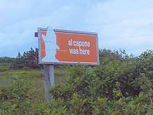 Al Capone sign near Point May |
Route 210 traverses the length of the Burin Peninsula, running along the northwest side of the peninsula between Marystown and Fortune. Route 220 runs from Fortune to Marystown on the southern side. A short connecting road Route 222 runs between these two roads west of Marystown. Routes 211, 212, 213, 214, 215, and 221 are numbered local roads.
The Burin Peninsula's economy is tied to the ocean, consequently most of its settlements are located on the coast; some are outports and have no road connection.
Communities on the north coast of the peninsula, beginning in the east:
- Terrenceville
- Harbour Mille
- Little Harbour East
- Bay L'Argent
- St. Bernard's-Jacques Fontaine
- Point Enragée
- Garnish
- Frenchman's Cove
- L'Anse-au-Loup
- Grand Bank
- Fortune
Communities on the south coast of the peninsula, beginning in the west:
- Lories
- Point May
- Calmer
- High Beach
- Allan's Island
- Lamaline
- Point au Gaul
- Taylor's Bay
- Lord's Cove
- Roundabout
- Lawn
- Little St. Lawrence
- St. Lawrence
- Epworth
- Lewin's Cove
- Burin Bay Arm
- Burin
- Port au Bras
- Fox Cove-Mortier
- Little Bay, Placentia Bay
- Creston
- Creston North
- Marystown
- Spanish Room
- Rock Harbour
- Jean De Baie
- Red Harbour
- Rushoon
- Baine Harbour
- Parkers Cove
- Boat Harbour West
- Boat Harbour
- Brookside
- Davis Cove
- Sandy Harbour
- Monkstown
- Great Paradise
- Little Paradise
- St. Joseph's
- Port Anne
- Petite Forte
- Clattice Harbour
- Clattice South West
- Burnt Island
- Murphy's Cove
- Isle Valen
- Darby's Harbour
- Great Bona
- Little Bona
- Southeast Bight
- Toslow
- Presque
- Saint Annes
- Saint Leonards
References
- The Canadian Press (2017), The Canadian Press Stylebook (18th ed.), Toronto: The Canadian Press