Buotama
The Buotama (Russian: Буотама) is a river in the Sakha Republic, Russia. It is a right tributary of the Lena and has a length of 418 km (260 mi).[1]
| Buotama Yakut: Буотама | |
|---|---|
.jpg) View of the river | |
 Location in the Sakha Republic, Russia | |
| Location | |
| Country | Sakha, Russia |
| Physical characteristics | |
| Source | |
| • location | Aldan Highlands |
| • coordinates | 59°57′2″N 124°27′39″E |
| • elevation | 500 m (1,600 ft) |
| Mouth | |
• location | Lena |
• coordinates | 61°15′56″N 128°45′15″E |
• elevation | 93 m (305 ft) |
| Length | 418 km (260 mi) |
| Basin size | 12,600 km2 (4,900 sq mi) |
| Discharge | |
| • average | 43 m3/s (1,500 cu ft/s) |
| Basin features | |
| Progression | Lena→ Laptev Sea |
There is a nursery of wood bisons for reintroductions by the Ust-Buotama Reservoir (Усть-Буотама) on the lower reaches of the river. It was opened in 2006 with bisons imported from Canada.[2]
Course
The river has its source in the northern part of the Aldan Highlands at an elevation of almost 500 metres (1,600 ft). It flows in an approximately ENE direction roughly parallel to the Lena through a relatively narrow valley by the Lena Plateau. Finally it makes a bend northwards and joins the right bank of the Lena, about 100 km (62 mi) upstream from the capital Yakutsk and 1,609 km (1,000 mi) from the Lena's mouth.[3]
The Buotama freezes between October and November and thaws between the end of April or early May. The river flows across the Olyokminsky and Khangalassky districts.[4]
The Buotama has over 60 tributaries that have a length over 10 km (6.2 mi). The main tributaries are the Kharya-Yuryakh and Kuyuda on the right and the Talalakh on the left. There are about 200 lakes in its basin.[4]
 View of the river from above |
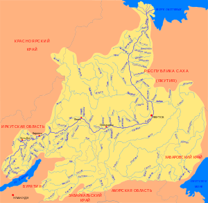
 Basin of the Lena |
 Wood bisons |
See also
References
- Russian State Water Register - Buotama River
- Ust-Buotama Bisonary
- Google Earth
- Buotama // Great Soviet Encyclopedia, in 30 vols. / Ch. ed. A.M. Prokhorov. - 3rd ed. - M .: Soviet Encyclopedia, 1969
External links

- Geography - Yakutia Organized