Bularung Sar
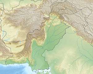
The Bularung Sar is a 7,134 m (according to other sources 7,110 m) high mountain, in the Karakoram mountains range in Nagar Valley, Gilgit-Baltistan, northern Pakistan.[1]
| Bularung Sar بلارنگ سر | |
|---|---|
 Bularung Sar بلارنگ سر Pakistan 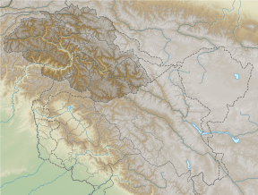 Bularung Sar بلارنگ سر Bularung Sar بلارنگ سر (Gilgit Baltistan) | |
| Highest point | |
| Elevation | 7,134 m (23,406 ft) |
| Listing | Ultra |
| Coordinates | 36°18′07″N 75°08′06″E |
| Geography | |
| Location | Shimshal Valley Gilgit-Baltistan, Pakistan |
| Parent range | Hispar Muztagh, Karakoram |
| Climbing | |
| First ascent | 9 June 1960 by Günther Stärker and Diether Marchart of an Austrian team |
| Easiest route | glacier/snow/ice climb |
The Bularung Sar is located in a mountain range of Hispar Muztagh between the western Trivor and the eastern Distaghil Sar. On the northern flank of the flows Momhilgletscher. On the southern slope runs Kunyanggletscher. The first ascent took place in July 1990 instead of by a Swiss expedition on the south ridge.[2] were members of the expedition: Alain Vaucher, Heinz Hügli, Lothar Matter, Carole Spleen, Thierry Bionda, Christian Meillard, Gerard Vouga, Vincent von Kaenel, Jean-Jacques Sauvain and Jacques Aymon.[3][4]
References
- "Google Maps". Google.com. Retrieved 2015-06-19.
- "Bularung Sar First ascent". Von-kaenel.com. 2013-12-31. Retrieved 2015-06-19.
- "Photo - Bularung Sar (7200m) see www.von-kaenel.com/bs - Pictures Of Ziarat, Northern Areas, Pakistan - Travel Photos :: AllTravels :: Anywhere You Want To Go ::". AllTravels.com. 2008-02-14. Retrieved 2015-06-19.
- "Rock Climbing Routes in Bularung Sar, peaks of pakistan". Rockclimbing.com. Retrieved 2015-06-19.
This article is issued from Wikipedia. The text is licensed under Creative Commons - Attribution - Sharealike. Additional terms may apply for the media files.