Buariki (Aranuka)
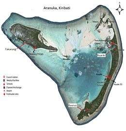
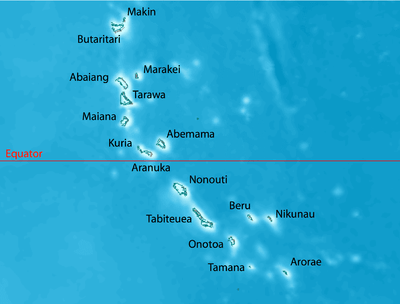
Buariki is the largest island in the Aranuka atoll of the Gilbert Islands in the Republic of Kiribati. Together with Takaeang the two large islands form the triangle shape of the atoll with Buariki forming the base.[1]
 Map of Aranuka | |
 | |
| Geography | |
|---|---|
| Location | Pacific Ocean |
| Coordinates | 0°09′N 173°35′E |
| Archipelago | Gilbert Islands |
| Area | 13.228 km2 (5.107 sq mi) |
| Highest elevation | 3 m (10 ft) |
| Administration | |
| Capital | Buariki |
| Demographics | |
| Population | 1,057 (2010 Census) |
| Pop. density | 79.9/km2 (206.9/sq mi) |
| Ethnic groups | I-Kiribati 99.6% |
Villages
- Baurua
- Buariki
Air transportation
The humble Aranuka Airport is located about one kilometre north of Buariki village.
gollark: Very late, but PotatoASM can probably handle syscalls of up to 6 parameters, which is surely enough for ANY possible usecase, through passing a bunch of register indices as operands to the `SYSC` instruction.
gollark: It's annoying that my internet connection is so bad right now.
gollark: https://twitter.com/x86instructions/status/1060477202045628418
gollark: https://twitter.com/x86instructions/status/982490887623098369
gollark: https://twitter.com/x86instructions/status/1060476411163492352very real x86 instruction which exists
See also
References
- "10. Aranuka" (PDF). Office of Te Beretitent - Republic of Kiribati Island Report Series. 2012. Retrieved 28 April 2015.
This article is issued from Wikipedia. The text is licensed under Creative Commons - Attribution - Sharealike. Additional terms may apply for the media files.
