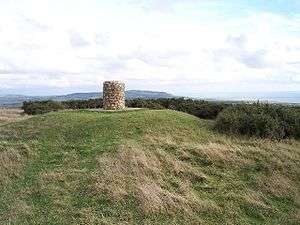
Brighstone Down
Brighstone Down is a chalk down on the Isle of Wight. It is located close to the village of Brighstone, in the southwest of the island (the Back of the Wight), and rises to 214 metres (702 ft) at its highest point,[1] northeast of the village of Mottistone. Towards the west part is called Mottistone Down, to the East, Shorwell Down.
| Brighstone Down | |
|---|---|
 Toposcope on the summit | |
| Highest point | |
| Elevation | 214 m (702 ft) |
| Prominence | c. 150 m |
| Parent peak | St Boniface Down |
| Listing | Marilyn |
| Geography | |
| Location | Isle of Wight, England |
| OS grid | SZ432847 |
| Topo map | OS Landranger 196 |
The Northern part is covered by Brighstone Forest the largest forest on the Island. [2]
Notes
- "Brighstone Down". Peakery. Retrieved 8 August 2015.
- http://www.iwpaths.co.uk/sota/actual_sota_brighstone_down.php%5B%5D
gollark: I guess if you just want one color (UV) there are probably UV-transparent LCD panels.
gollark: I mean, you could stick UV LEDs and a diffuser thing in place of the screen, but then it can't display anything.
gollark: I don't think it would be practical to make it still phoneish.
gollark: > Chemotherapy is in simple terms killing cancer with radiation<@224206995257950220> No, that would be radiotherapy.
gollark: Chemotherapy is an entirely different thing too.
This article is issued from Wikipedia. The text is licensed under Creative Commons - Attribution - Sharealike. Additional terms may apply for the media files.