Bridge of Muchalls
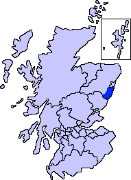
Bridge of Muchalls is an entirely residential hamlet in Aberdeenshire, Scotland by the North Sea.[1] It is on the A90 dual carriageway about three miles north of Stonehaven and to the south of Muchalls Castle.

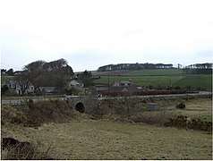
The bridge at Bridge of Muchalls
This small hamlet is known for its picturesque access to the rugged North Sea coastline at Muchalls Beach.[2] The Burn of Muchalls is a stream that flows east through the Bridge of Muchalls before passing under the A90 roadway and thence to the North Sea slightly to the north of Doonie Point. The ancient Causey Mounth trackway runs north from the now ruin Cowie Castle, past the Hill of Megray and passes over Kempstone Hill before crossing the Burn of Muchalls at the Bridge of Muchalls.[3]
See also
- Fetteresso Castle
- Mill of Muchalls
- Netherley
- Red Moss
References
- United Kingdom Ordnance Survey Map Landranger 45, Stonehaven and Banchory, 1:50,000 scale, 2004
- Muchalls beach Archived June 10, 2007, at the Wayback Machine
- C.Michael Hogan, Causey Mounth, Megalithic Portal, ed. by Andy Burnham, Nov. 3, 2007
| Wikimedia Commons has media related to Bridge of Muchalls. |
This article is issued from Wikipedia. The text is licensed under Creative Commons - Attribution - Sharealike. Additional terms may apply for the media files.

