Brda (river)
The Brda (Polish: [brda] (![]()
| Brda | |
|---|---|
 Brda flowing through Bydgoszcz | |
| Location | |
| Country | Poland |
| Physical characteristics | |
| Mouth | |
• location | Vistula |
• coordinates | |
| Length | 245 km (152 mi) |
| Basin size | 4,665 km2 (1,801 sq mi) |
| Discharge | |
| • average | 28.0 m3/s (990 cu ft/s) |
| Basin features | |
| Progression | Vistula→ Baltic Sea |
Navigation
The Brda is part of the Odra-Vistula waterway, connecting these two rivers via the Warta and Noteć Rivers and the Bydgoszcz Canal since end of the 18th century. The waterway is navigable for modest barges (of CEMT Class II) but with a limited draught.
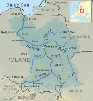
With the expansion of the European Union to the East, the waterway could play an important role. It is a link in the much longer connection with Eastern Europe via the Vistula, Narew, Bug, Mukhavets, Pripyat, and Dnieper Rivers, but this connection remains unnavigable due to a dam near Brest, Belarus.
Currently, only limited numbers of vessels use the Brda River and the adjacent canal (however, the traffic was significantly larger from 1950s to 1970s, then diminishing step by step as time went by). It is expected that the waterway will be discovered by leisure boaters in the future. (Source: NoorderSoft Waterways Database)
Towns and townships on Brda
- Przechlewo
- Konarzyny (German: Konarschin (until WW I), Kunertsfeld (during WW II), Kashubian: Kònarzënë)
- Tuchola (German: Tuchel)
- Koronowo (German: Krone, Polnisch Krone, Krone an der Brahe)
- Bydgoszcz (German: Bromberg)
See also
References
- Statistical Yearbook of the Republic of Poland 2017, Statistics Poland, p. 85-86
| Wikimedia Commons has media related to Brda. |
