Braybrooke
Braybrooke is a small village in north west Northamptonshire, England. The population of the civil parish at the 2011 census was 378.[1] It is situated about halfway between Market Harborough and Desborough. It lies in a valley between two ridges one of which is surmounted by the A6 trunk road. The surrounding land in the parish is a mixture of pasture and arable.
| Braybrooke | |
|---|---|
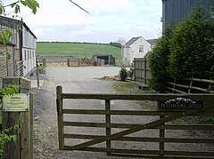 Braybrooke Lodge gate | |
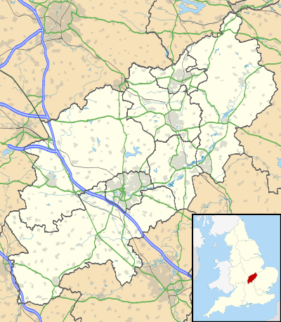 Braybrooke Location within Northamptonshire | |
| Population | 378 (2011) |
| OS grid reference | SP7684 |
| District | |
| Shire county | |
| Region | |
| Country | England |
| Sovereign state | United Kingdom |
| Post town | MARKET HARBOROUGH |
| Postcode district | LE16 |
| Dialling code | 01858 |
| Police | Northamptonshire |
| Fire | Northamptonshire |
| Ambulance | East Midlands |
| UK Parliament | |
Church of All Saints
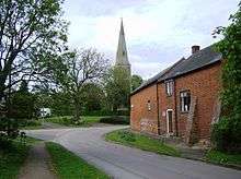
The most significant building in modern Braybrooke is the Church, dedicated to All Saints. This lies on the central village cross-roads and a key feature is the magnificent elongated spire which was built in the late 14th century or early 15th century.
The oldest surviving parts of the church, the moulded south doorway and the eastern bay of the nave, are thought to date from the 13th century. The church was extended considerably in the 14th century. After two centuries of neglect significant and sympathetic restoration work was done over a long period in the late 19th and early 20th centuries.
Braybrooke Castle
Braybrooke Castle is today no more than a large area of extensive earthworks on the east side of the village. The castle was actually a fortified manor house associated, in the main, with two families - Latimer and Griffin. All that is visible today is the platform on which the manor house stood and the remains of both large and small fish ponds which served the manor.
First mentioned in the mid C12. c.1200 documents mention fishponds already in use. The acquisition of timber for building work is recorded in 1213, and a garden in 1292. In 1304 Thomas de Latimer was granted a licence to strengthen his manor house at Braybrooke and documentary sources indicate that the moated house was constructed at this time. In 1329-30 there is mention of a waterfilled moat. Described as a castle in 1361. The manor passed to the Griffin family in the early C15. The castle buildings were used as a farmhouse from 1549-50 until demolition prior to 1633. A mid-C17 farmhouse stood on the site until 1960.[2]
On 12 August 1605 King James I and Anne of Denmark came from Kirby Hall and visited Edward Griffin at the castle, and travelled on to Great Harrowden.[3]
Other Information Related To The Castle
The road that spouts into Latimer Close is Griffin Road. Griffin Road was originally called Arthingworth Road and the name was changed to Griffin Road in 1867 by Helena Tafer who died after giving birth to two children (her great-grandson is the farmer that owns the fields behind 63 Appledene).
Famous residents past and present
- Sir Thomas Latimer - Lord of the manor and leading figure in the Lollard movement.
- Robert of Braybrooke - landowner, justice and sheriff (1168-1210)
- Graham Moffatt - comic actor
References
- "Civil Parish population 2011". Neighbourhood Statistics. Office for National Statistics. Retrieved 29 June 2016.
- "CastleFacts". Castlefacts.info. Archived from the original on 21 July 2011. Retrieved 6 March 2014.
- John Nichols, The Progresses of James the First, vol. 1 (London, 1828), p. 526.
External links
| Wikimedia Commons has media related to Braybrooke. |