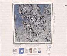
Bowers Mountains
Bowers Mountains (71°10′S 163°15′E) is a group of north–south trending mountains in Antarctica, about 145 km (90 mi) long and 56 km (35 mi) wide, bounded by the coast on the north and by the Rennick, Canham, Black and Lillie glaciers in other quadrants. The seaward end was first sighted in February 1911 from the Terra Nova, under Lt. Harry L.L. Pennell, RN, and was subsequently named "Bowers Hills" in honour of Henry Robertson Bowers who perished with Captain Robert Falcon Scott on their return from the South Pole in 1912. The mountain range is one of the most extensive topographical features within Victoria Land.

The feature was photographed from U.S. Navy aircraft in 1946-47 and 1960–62, and was surveyed and mapped by the United States Geological Survey (USGS) in 1962–63. The name was amended to Bowers Mountains upon USGS mapping which showed the group to be a major one with peaks rising to nearly 2,600 metres. The major topographical feature lies situated within the Pennell Coast region of Victoria Land, Antarctica.
Features
Geographical features include:
Explorers Range
Lanterman Range
Molar Massif
Posey Range
Other features
- Adams Ridge
- Astapenko Glacier
- Barber Glacier
- Black Glacier
- Carryer Glacier
- Centropleura Spur
- Champness Glacier
- Copperstain Ridge
- Curphey Peaks
- Dow Peak
- Edlin Névé
- Flensing Icefall
- Frolov Ridge
- Gambone Peak
- Gannutz Glacier
- Gateway Hills
- Griffith Ridge
- Helix Pass
- Ian Peak
- Irwin Glacier
- Lillie Glacier
- Markinsenis Peak
- McCann Glacier
- McKenzie Nunatak
- McLin Glacier
- Montigny Glacier
- Mount Ashworth
- Mount Belolikov
- Mount Bradshaw
- Mount Bruce
- Mount Cantello
- Mount Dergach
- Mount Freed
- Mount Gow
- Mount Jamroga
- Mount Janus
- Mount Keith
- Mount Nagata
- Mount Overlook
- Mount Radspinner
- Mount Shearer
- Mount Soza
- Mount Verhage
- Mount Wodzicki
- Platypus Ridge
- Rosenau Head
- Sledgers Icefall
- Stanwix Peak
- Stuhlinger Ice Piedmont
- Van Loon Glacier