Borisoglebsky, Murmansk Oblast
Borisoglebsky or Boris Gleb (Russian: Борисоглебский; Norwegian: Skoltfossen) is a rural locality (a Posyolok) in Pechengsky District of Murmansk Oblast, Russia. The village is located beyond the Arctic circle, at a height of 95 meters above sea level on the Paatsjoki River.
Borisoglebsky Борисоглебский | |
|---|---|
Location of Borisoglebsky 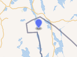
| |
 Borisoglebsky Location of Borisoglebsky  Borisoglebsky Borisoglebsky (Murmansk Oblast) | |
| Coordinates: 69°39′0″N 30°4′59″E | |
| Country | Russia |
| Federal subject | Murmansk Oblast[1] |
| Administrative district | Pechengsky District[1] |
| Founded | 1961 |
| Elevation | 95 m (312 ft) |
| Population | |
| • Total | 21 |
| Time zone | UTC+3 (MSK |
| Postal code(s)[4] | 184420 |
| Dialing code(s) | +7 81554[5] |
| OKTMO ID | 47615151106 |
There is a border crossing to Storskog in Norway, the only border crossing between the two countries.
1968 border provocation
In June 1968, Boris Gleb was the venue for the largest Soviet demonstration of power against Norway since the Second World War. Early in the morning on 7 June 1968, 60-70 T-54 tanks rolled towards the Norwegian border. The garrison stationed at southern Varanger was placed at the highest alert. The soldiers were given live ammunition and prepared for an armed conflict. According to the instructions they were given, any violation of the border should be fired upon. The Soviet army stopped 30 meters away, aiming their tanks at Norwegian military installations. The confrontation lasted until 10 June, when Soviet forces retired from the border area.
Boris Gleb hydroelectric station
Built between 1960 and 1964, the Boris Gleb (Borisoglebskaya) hydroelectric station (Russian: Борисоглебская ГЭС (ГЭС-8)) on the Paatsjoki River is a hydroelectric station built under a water derivation system. The power station is owned and operated by TGC-1 power company.
References
- OKATO, Part 2. Code 47 215 551
- Статистический сборник Численность, размещение и возрастно-половой состав населения Мурманской области. Итоги Всероссийской переписи населения. Том 1. 2012 Archived 2012-12-22 at the Wayback Machine / Федеральная служба государственной статистики, Территориальный орган Федеральной службы государственной статистики по Мурманской области. Мурманск, 2012 — 75 с.
- "Об исчислении времени". Официальный интернет-портал правовой информации (in Russian). 3 June 2011. Retrieved 19 January 2019.
- Russian Post. Эталонный справочник индексов объектов почтовой связи Archived 2007-01-12 at the Wayback Machine (in Russian)
- Народная энциклопедия городов и регионов России «Мой Город» (in Russian)