Bois-Franc station
Bois-Franc is a commuter rail station operated by Exo in the Bois-Franc neighbourhood of Montreal, Quebec, Canada. It is served by the Deux-Montagnes line.
Bois-Franc | |||||||||||||||||||||||||||||||||
|---|---|---|---|---|---|---|---|---|---|---|---|---|---|---|---|---|---|---|---|---|---|---|---|---|---|---|---|---|---|---|---|---|---|
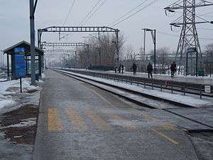 | |||||||||||||||||||||||||||||||||
| Location | 5465 Henri-Bourassa Blvd. West, Montreal, Quebec[1] | ||||||||||||||||||||||||||||||||
| Coordinates | 45°31′23″N 73°42′35″W | ||||||||||||||||||||||||||||||||
| Operated by | Réseau de transport métropolitain | ||||||||||||||||||||||||||||||||
| Connections | Société de transport de Montréal | ||||||||||||||||||||||||||||||||
| Construction | |||||||||||||||||||||||||||||||||
| Parking | |||||||||||||||||||||||||||||||||
| Bicycle facilities | 21 spaces[1] | ||||||||||||||||||||||||||||||||
| Other information | |||||||||||||||||||||||||||||||||
| Fare zone | 2 | ||||||||||||||||||||||||||||||||
| Website | Bois-Franc station (Exo) | ||||||||||||||||||||||||||||||||
| History | |||||||||||||||||||||||||||||||||
| Opened | 1994 | ||||||||||||||||||||||||||||||||
| Electrified | 25 kV AC 60 Hz catenary | ||||||||||||||||||||||||||||||||
| Previous names | Lazard, Val-Royal | ||||||||||||||||||||||||||||||||
| Traffic | |||||||||||||||||||||||||||||||||
| Passengers (2019[2]) | 737,900 (Exo) | ||||||||||||||||||||||||||||||||
| Services | |||||||||||||||||||||||||||||||||
| |||||||||||||||||||||||||||||||||
| Other services | |||||||||||||||||||||||||||||||||
| |||||||||||||||||||||||||||||||||
Origin of name
Bois-Franc takes its name from the nearby Bois-Franc residential development, itself named for chemin du Bois-Franc, the original name of the stretch of boulevard Henri-Bourassa through this area, which had previously ended at the Laurentian Autoroute. Bois Franc was also the original name of the nearby pioneer airstrip that later was known as Cartierville Airport, until its closing in the 1980s.
History
The original station was named Lazard [3] (likely for the merchant bank Lazard Frères & Co. which underwrote the construction of the Mount Royal Tunnel on this railline). In 1926 the station was renamed Val-Royal. After the modernization of the Deux-Montagnes Line, between 1993 and 1995, a new station named Bois-Franc was built; the original station was then demolished at the request of the Canadian National Railway and with the permission of Transport Canada, on June 5, 1995.[4]
Location
The station is located at 5465 Henri Bourassa Boulevard West, between Marcel-Laurin Boulevard/Boulevard Laurentien (Route 117) and Grenet Street in Saint-Laurent on the border with Cartierville.
Cartierville branch and station
A single-track electrified (2400 V DC) branch to Cartierville, a relic of when the line terminated there in Canadian Northern Railway days, left the line at (then) Val-Royal station. When the line was run by Canadian National, only one rush-hour trip was scheduled in each direction. It was abandoned in the early 1980s when STM predecessor STCUM took over operations of the Deux-Montagnes line. The Cartierville station was located at the corner of Gouin West and Laurentian boulevards.[5] The Cartierville Station was to have been the terminus of Line 3 (Red) of the Montreal Metro.
Connecting bus routes
| Société de transport de Montréal | |||
|---|---|---|---|
| No.[1] and Route Name | Service Times | Route Map | Schedule |
| All-Day | Map | Schedule | |
| School Day Service, Located on Grenet and Henri-Bourassa | Map | Schedule | |
| All-Day | Map | Schedule | |
| All-Day | Map | Schedule | |
| Rush Hours | Map | Schedule | |
| Regular, Located on blvd. Henri-Bourassa and Marcel-Laurin | Map | Schedule | |
| Overnight | Map | Schedule | |
| Weekdays before 8:00PM, Located on Grenet and Henri-Bourassa | Map | Schedule | |
| Rush hour |
TBA |
TBA | |
| Société de transport de Laval | |||
| No.[1][6] and Route Description | Service Times | Route Map (Click on "Route map") | Schedule |
| 55 to/from Laval-Ouest and Henri-Bourassa Terminus Nord via Du Ruisseau station and via Bois-de-Boulogne station. The stops are on Grenet Street. |
Regular | Map | Schedule, north bound South bound |
| 144 to/from Sainte-Dorothée, Chomedey, and Terminus Côte-Vertu at the Côte-Vertu Metro station. The stops are on Marcel Laurin Boulevard. |
Map | Schedule, west bound East bound | |
| 151 to/from Chomedey, Fabreville, Sainte-Rose and Terminus Côte-Vertu at the Côte-Vertu Metro station. The stops are on Marcel Laurin Boulevard. |
Map | Schedule, north bound South bound | |
| 902 to/from Terminus Le Carrefour at Le Carrefour Laval and Terminus Côte-Vertu at the Côte-Vertu Metro station. The stops are on Marcel Laurin Boulevard. |
Regular, on week days | Map | Schedule, north bound South bound |
| |||
References
- Bois-Franc (RTM)
- Exo (2020-06-17). Réponse à votre demande d'accès à l'information (Report) – via Access to Information Act request, reference no. 2020-25.
- Walton, Mark (June 6, 2000). "The Mount Royal Tunnel Electrification". Colin Churcher's Railway Pages. Archived from the original on January 18, 2012.
- N/Réf. T6165/S7 & V/Réf. 5105-VAL-1
- "Montreal-Cartierville-Deux-Montagnes schedule 1979 pages 3&4". Canadian National suburban Montreal public timetable, August 6, 1979. Retrieved 2 October 2011.
- STL 2011 map Archived 2011-09-20 at the Wayback Machine
External links
- Bois-Franc Commuter Train Station Information (RTM)
- Bois-Franc Commuter Train Station Schedule (RTM)
- 2016 STM System Map
- STL 2011 map
![]()