Bohicon
Bohicon is a city in Benin, and a conurbation of Abomey lying 9 kilometres east of the city on the railway line from Cotonou to Parakou and on Benin's main highway RNIE 2 which joins the RNIE 4. The commune covers an area of 139 square kilometres and as of 2002 had a population of 113,091 people.[1][2]
Bohicon | |
|---|---|
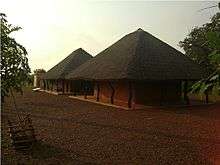
Road leading into Bohicon from the south | |
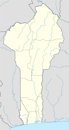
 Bohicon Location in Benin | |
| Coordinates: 7°12′N 2°04′E | |
| Country | |
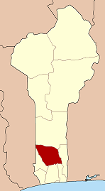
| Department | Zou Department |
| Area | |
| • Total | 44 km2 (17 sq mi) |
| Elevation | 167 m (548 ft) |
| Population (2012) | |
| • Total | 149,271 |
| • Density | 3,400/km2 (8,800/sq mi) |
| Time zone | UTC+1 (WAT) |
Bohicon is the crossroads of international trade at the center of Benin. Bohicon is an important in communications in Benin and branches to the various departments of the country, including to the north of Benin and on to Niger or Burkina Faso and even Togo or Nigeria. Bohicon is a relatively new city compared to Abomey and Allada and was founded in the 20th century with the installation of the railway station on the Cotonou–Parakou railway and the central market.
Cityscape and economy
The city has a mosque and the Jehovah's Witnesses also have a church in Bohicon. A congregation of The Church of Jesus Christ of Latter-day Saints was established in the city in October 2019.
Bohicon Railway Station is located in the city centre and the main hotel worth mentioning is the Jardin de l'Hotel de Ville De Bohicon which is set in a garden park with a restaurant.
Given the excellent road and rail networks that connect to Bohicon, it is an important trade centre that is the third largest in the country after Cotonou and Parakou. Trade is the primary activity of the city and its real name "Gboxicon" derives from the extensive sheep marketing that takes places in the city, literally meaning "market sheep". The market is of considerable size and there is a notable drum shop located in Bohicon. The Maquis Malodie market is also known for its cuisine with a number of stalls serving omelette and coffee in the mornings and stacks of pepper and attracts thousands of traders from all over Benin.[3] A speciality sold in the market is afitin (soy dawa-dawa/soy iru), which is traditionally and somewhat famously in Benin made by women in the region. It is a protein-rich fermented food widely used in West Africa as a seasoning.
After sheep marketing and the processing of food, industrial handcraft is also important in the local economy including textiles. Thousands of craftsmen and craftswomen produce in the privacy of their workshop products for export. In the surrounding area in Bohicon commune, a number of agricultural crops are produced in subsistence farming including maize, cotton, peanuts and oil, yams, sorghum and cassava many of which are cultivated in plantations. There are also small livestock farms with cattle and goats. In short, trade and transportation alone occupy more than 40% of the population. As an economic effect though, Bohicon faces serious problems with the environment and sanitation due to industrial waste.
Climate
| Climate data for Bohicon (1961–1990) | |||||||||||||
|---|---|---|---|---|---|---|---|---|---|---|---|---|---|
| Month | Jan | Feb | Mar | Apr | May | Jun | Jul | Aug | Sep | Oct | Nov | Dec | Year |
| Record high °C (°F) | 36.7 (98.1) |
37.8 (100.0) |
37.7 (99.9) |
36.5 (97.7) |
34.9 (94.8) |
33.5 (92.3) |
31.7 (89.1) |
31.8 (89.2) |
32.9 (91.2) |
33.9 (93.0) |
35.3 (95.5) |
35.4 (95.7) |
37.8 (100.0) |
| Average high °C (°F) | 34.4 (93.9) |
35.8 (96.4) |
35.2 (95.4) |
33.8 (92.8) |
32.4 (90.3) |
30.7 (87.3) |
29.3 (84.7) |
29.1 (84.4) |
30.2 (86.4) |
31.7 (89.1) |
33.8 (92.8) |
33.8 (92.8) |
32.5 (90.5) |
| Daily mean °C (°F) | 28.4 (83.1) |
29.7 (85.5) |
29.5 (85.1) |
28.7 (83.7) |
27.8 (82.0) |
26.4 (79.5) |
25.5 (77.9) |
25.3 (77.5) |
26.0 (78.8) |
27.0 (80.6) |
28.4 (83.1) |
28.1 (82.6) |
27.6 (81.7) |
| Average low °C (°F) | 22.4 (72.3) |
23.6 (74.5) |
23.9 (75.0) |
23.6 (74.5) |
23.1 (73.6) |
22.2 (72.0) |
21.8 (71.2) |
21.5 (70.7) |
21.7 (71.1) |
22.2 (72.0) |
22.9 (73.2) |
22.4 (72.3) |
22.6 (72.7) |
| Record low °C (°F) | 19.2 (66.6) |
21.0 (69.8) |
21.0 (69.8) |
20.9 (69.6) |
20.6 (69.1) |
20.2 (68.4) |
20.1 (68.2) |
20.3 (68.5) |
20.3 (68.5) |
20.3 (68.5) |
20.7 (69.3) |
19.0 (66.2) |
19.0 (66.2) |
| Average precipitation mm (inches) | 3.6 (0.14) |
28.3 (1.11) |
74.9 (2.95) |
127.3 (5.01) |
153.2 (6.03) |
175.0 (6.89) |
142.2 (5.60) |
112.4 (4.43) |
140.0 (5.51) |
118.8 (4.68) |
22.3 (0.88) |
14.4 (0.57) |
1,112.4 (43.80) |
| Average precipitation days (≥ 1.0 mm) | 1 | 2 | 5 | 9 | 10 | 12 | 9 | 8 | 9 | 9 | 2 | 1 | 77 |
| Mean monthly sunshine hours | 210.8 | 201.6 | 204.6 | 204.0 | 210.8 | 171.0 | 114.7 | 96.1 | 123.0 | 195.3 | 231.0 | 213.9 | 2,176.8 |
| Mean daily sunshine hours | 6.8 | 7.2 | 6.6 | 6.8 | 6.8 | 5.7 | 3.7 | 3.1 | 4.1 | 6.3 | 7.7 | 6.9 | 6.0 |
| Source: NOAA[4] | |||||||||||||
Administration
Bohicon is one of the 77 official Communes of Benin. The city is located 9 kilometres from Abomey but the commune is divided into arrondissements:
- Bohicon 1
- Bohicon 2
- Sdohomé
- Saclo
- Passangon
- Ouassaho
- Lissezoun
- Gnidjazoun
- Avogbana
- Agongointo
Notable landmarks
- Lycée Technique de Bohicon (LYTEB)
- Collège Monseigneur Steinmetz
- Bohicon Railway Station
- Parc Archeologique d'Agongointo

Notable people
- Nicéphore Dieu-Donné Soglo - former President of Benin
- Hubert Maga - Born in Parakou but studied in Bohicon.
- Abraham Zinzindohoue - former Benin Minister of Justice
- Ben La Desh - Musician from Rotterdam but born in Bohicon.
References
- "Bohicon". Atlas Monographique des Communes du Bénin. Retrieved January 5, 2010.
- "Communes of Benin". Statoids. Archived from the original on April 30, 2012. Retrieved January 5, 2010.
- Butler, Stuart (2006). Benin. Bradt Travel Guides, The Globe Pequot Press, Guilford, Connecticut. p. 160.
- "Bohicon Climate Normals 1961–1990". National Oceanic and Atmospheric Administration. Retrieved January 13, 2015.
External links
| Wikimedia Commons has media related to Bohicon. |

