Birkenfeld, Oregon
Birkenfeld is an unincorporated community in Columbia County, Oregon, United States, in the Nehalem Valley on Oregon Route 202 between Jewell and Mist.[1]

History
German immigrant Anton Birkenfeld settled in the Nehalem Valley in 1886 and founded Birkenfeld in about 1910.[2] Birkenfeld's post office was founded in 1916,[2] bringing much-needed mail service on a more local basis. As of 2010, the Birkenfeld post office has been closed permanently.[3] Although mail can still be addressed directly to the defunct post office, the community has a Clatskanie ZIP code, 97016 and all mail directed toward Birkenfeld is automatically redirected there.[3]
As of the 1990s the community had a store, a café, a tavern, a garage, and a church.[4][5]
Geography
Climate
Birkenfeld has a warm-summer Mediterranean climate (Köppen Csb) with cool and cloudy winters, and warm, dry summers. [6]. This climate is characterized by having overcast, wet, and changing weather conditions in fall, winter, and spring, as Newberg lies in the direct path of the stormy westerly flow, and mild and dry summers when the Pacific High reaches in northernmost point in mid summer.[7]
According to the Köppen climate classification, Birkenfeld falls within the dry-summer temperate zone (Csb).[7][8] with a USDA Plant Hardiness Zones between 8b and 9a.[9] Other climate systems, such as the Trewartha climate classification, places it within the oceanic zone (Do), like much of the Pacific Northwest and Western Europe.[10]
Winters are cool, cloudy, and rainy. The coldest month is December with an average daily high of 44.0 °F (6.7 °C), although overnight lows usually remain above freezing by a few degrees. Evening temperatures fall to or below freezing 33 nights per year on average, but very rarely to or below 18 °F (−8 °C).
Annual snowfall in Birkenfeld falls during the December-to-March time frame.
Summers in Birkenfelm are warm, occasionally hot, dry, and sunny, though the sunny warm weather is short lived from mid June through early September. The months of June, July, August and September account for a combined 5.4 inches (137 mm) of total rainfall – of the 54.7 in (1,389 mm) of the precipitation that falls throughout the year. The warmest months are July and August, with an average high temperature of 78.0 °F (25.6 °C). Because of its location 46 miles (74 km) to the coast, as well as the protective nature of the Oregon Coast Range to its west, Birkenfeld summers are less susceptible to the moderating influence of the nearby Pacific Ocean. Spring and fall can bring variable weather including warm fronts that send temperatures surging above 80 °F (27 °C) and cold snaps that plunge daytime temperatures into the 40s °F (4–9 °C). However, lengthy stretches of overcast days beginning in mid fall and continuing into mid spring aare most common. Rain often falls as a light drizzle for several consecutive days at a time, contributing to 152 days on average with measurable (≥0.01 in or 0.25 mm) precipitation annually.
| Climate data for Birkenfeld, Oregon | |||||||||||||
|---|---|---|---|---|---|---|---|---|---|---|---|---|---|
| Month | Jan | Feb | Mar | Apr | May | Jun | Jul | Aug | Sep | Oct | Nov | Dec | Year |
| Average high °F (°C) | 46.0 (7.8) |
48.0 (8.9) |
52.0 (11.1) |
58.0 (14.4) |
65.0 (18.3) |
69.0 (20.6) |
78.0 (25.6) |
78.0 (25.6) |
72.0 (22.2) |
60.0 (15.6) |
50.0 (10.0) |
44.0 (6.7) |
60.0 (15.6) |
| Average low °F (°C) | 37.0 (2.8) |
37.0 (2.8) |
38.0 (3.3) |
40.0 (4.4) |
46.0 (7.8) |
50.0 (10.0) |
54.0 (12.2) |
55.0 (12.8) |
52.0 (11.1) |
46.0 (7.8) |
41.0 (5.0) |
36.0 (2.2) |
44.3 (6.8) |
| Average precipitation inches (mm) | 8.2 (210) |
6.0 (150) |
6.2 (160) |
4.1 (100) |
2.6 (66) |
1.7 (43) |
0.6 (15) |
0.9 (23) |
2.2 (56) |
4.3 (110) |
8.6 (220) |
9.3 (240) |
54.7 (1,393) |
| Average snowfall inches (cm) | 1.8 (4.6) |
1.1 (2.8) |
0.3 (0.76) |
0 (0) |
0 (0) |
0 (0) |
0 (0) |
0 (0) |
0 (0) |
0 (0) |
0.3 (0.76) |
1.3 (3.3) |
4.8 (12.22) |
| Average precipitation days | 17 | 14 | 17 | 14 | 10 | 7 | 2 | 3 | 6 | 11 | 17 | 18 | 136 |
| Average snowy days | 1 | 0 | 0 | 0 | 0 | 0 | 0 | 0 | 0 | 0 | 0 | 0 | 1 |
| Source: NOAA[11] | |||||||||||||
References
- "Birkenfeld". Geographic Names Information System. United States Geological Survey. November 28, 1980. Retrieved 2010-01-10.
- McArthur, Lewis A.; McArthur, Lewis L. (2003) [1928]. Oregon Geographic Names (7th ed.). Portland, Oregon: Oregon Historical Society Press. p. 84. ISBN 978-0875952772.
- "USPS ZIP Code Lookup". Archived from the original on 2007-09-03.
- Friedman, Ralph (1990). In Search of Western Oregon. Caldwell, Idaho: The Caxton Printers, Ltd. p. 144. ISBN 0-87004-332-3.
- Friedman, Ralph (1993) [1972]. Oregon for the Curious (3rd ed.). Portland, Oregon: Pars Publishing Company. p. 36. ISBN 0-87004-222-X.
- Anderson 2014, p. 138.
- "Global Ecological Zoning for the Global Forest Resources Assessment 2000". Forestry Department of the Food and Agriculture Organization. 2001. Retrieved September 12, 2012.
- Kottek, M.; J. Grieser; C. Beck; B. Rudolf; F. Rubel (2006). "World Map of the Köppen-Geiger climate classification updated". Meteorol. Z. 15 (3): 259–263. Bibcode:2006MetZe..15..259K. doi:10.1127/0941-2948/2006/0130. Retrieved February 15, 2007.
- "USDA Plant Hardiness Zone Map". United States Department of Agriculture. Archived from the original on February 27, 2014. Retrieved June 1, 2014.
- "Global ecological zoning for the global forest resources assessment 2000". Food And Agriculture Organisation of the United Nations. Retrieved January 30, 2016.
- "Monthly Averages for Birkenfeld, OR". 2020. Retrieved July 30, 2020.
External links
- Historic image of Birkenfeld store from Salem Public Library
- Image of barn in Birkenfeld from Oregon Scenic Images for Columbia County from Oregon State Archives
Municipalities and communities of Columbia County, Oregon, United States | ||
|---|---|---|
| Cities | 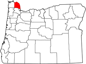 Columbia County map | |
| CDPs | ||
| Other unincorporated communities | ||