Biar Bandh
Biar Bandh is a village in Sheosagar block of Rohtas district in Bihar state, India. As of 2011, its population was 987, in 212 families.[2]
Biar Bandh Biarbāndh | |
|---|---|
village | |
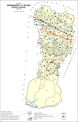 Map showing Biar Bandh (#139) in Sheosagar block. | |
 Biar Bandh Location in Bihar, India  Biar Bandh Biar Bandh (India) | |
| Coordinates: 25.02534°N 83.88299°E[1] | |
| Country | |
| State | Bihar |
| District | Rohtas |
| Area | |
| • Total | 1.72 km2 (0.66 sq mi) |
| Population | |
| • Total | 987 |
| • Density | 570/km2 (1,500/sq mi) |
| Languages | |
| • Official | Bhojpuri, Hindi |
| Time zone | UTC+5:30 (IST) |
| ISO 3166 code | IN-BR |
| Vehicle registration | BR-24 |
| Coastline | 0 kilometres (0 mi) |
| Nearest city | Sasaram |
Agriculture
Biar Bandh has an agricultural credit society. It has 127.4 hectares of farmland, in addition to 1.3 hectares of permanent pasturage. Most of the land (103.4 hectares) was irrigated in 2011, mostly by canal.[2]
Amenities
As of 2011, Biar Bandh possessed a single primary school. It had no medical facilities or post office. Biar Bandh had both landline and cell phone coverage, but no internet access. Villagers had access to electricity, but not tap water; drinking water instead was provided by hand pump. It had no permanent pucca roads; rather, it had impermanent kuccha roads.[2]
gollark: No, colourbotoid.
gollark: Although actually, it might not be a good idea to do anything which would make Discord notice us.
gollark: Well, we need 500 for [REDACTED].
gollark: BEES YOU, Google.
gollark: Potentially.
References
- "Geonames.org. Biarbāndh". Retrieved 20 May 2020.
- "Census of India 2011: Bihar District Census Handbook - Rohtas, Part A (Village and Town Directory)". Census 2011 India. pp. 900–980, 1191–1192. Retrieved 1 April 2020.
This article is issued from Wikipedia. The text is licensed under Creative Commons - Attribution - Sharealike. Additional terms may apply for the media files.