Białopole, Lower Silesian Voivodeship
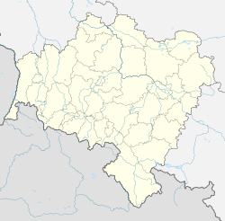
Białopole [bjawɔˈpɔlɛ] (German: Sommerau) is a village in the administrative district of Gmina Bogatynia, within Zgorzelec County, Lower Silesian Voivodeship, in south-western Poland, close to the Czech and German borders.[1] Prior to 1945 it was in Germany.
Białopole | |
|---|---|
Village | |
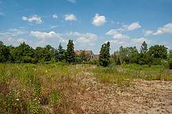
 House in Białopole in 2019 | |
 Białopole  Białopole | |
| Coordinates: 50°52′49″N 14°54′04″E | |
| Country | |
| Voivodeship | Lower Silesian |
| County | Zgorzelec |
| Gmina | Bogatynia |
It lies approximately 7 kilometres (4 mi) south-west of Bogatynia, 31 kilometres (19 mi) south of Zgorzelec, and 153 kilometres (95 mi) west of the regional capital Wrocław.
Gallery
 A house
gollark: And is not 2/2.5m away from.the stuff.
gollark: The point you have marked is just some weird point on a line between them.
gollark: It's not. It's really not.
gollark: Not the thing in the middle.
gollark: You want the point where the circumferences intersect...
This article is issued from Wikipedia. The text is licensed under Creative Commons - Attribution - Sharealike. Additional terms may apply for the media files.
