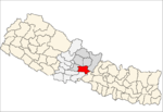
Bhimad
Bhimad is a proposed sub-metropolitan city in Tanahu District in the Gandaki Zone of central Nepal. At the time of the 2011 Nepal census the city had a population of 8,414 people living in 2,191 individual households.[1] It is 30 minutes away from Khairenitar. Due to its historic importance, a plan is underway to incorporate the Shukla Gandaki municipality and form the Bhimad Sub-metropolitan City in the near future. This is being done in order to improve the integrated development of this region because the city is currently experiencing accelerated development. While Bhimad lacks sufficient hospital facilities for its population size,[2] there are many health centers in various communities.
Bhimad भिमाद Bhimad Municipality | |
|---|---|
| Nickname(s): BHim Baad | |
 Bhimad Location in Nepal | |
| Coordinates: 28.00°N 84.07°E | |
| Country | |
| Zone | Gandaki Zone |
| District | Tanahu District |
| Government | |
| • Mayor | Mekh Bahadur Thapa (NCP) |
| • Deputy Mayor | Sarada Khanal (NCP) |
| Population (2011) | |
| • Total | 8,414 |
| Time zone | UTC+5:45 (Nepal Time) |
| Area code(s) | 065 |
| Website | bhimadmun |
Simle
Simle is a famous and historical part of the Village Development Committee (VDC). It is a growing commercial and economic hub near the Shuklgandaki Municipality. Construction of a motorway bridge from Dovan is underway. Simle has 1 high school and 1 primary school. An expansion of the Community Health Unit in Simle is underway, which will make it the primary health center in the area with both outpatient and inpatient services.Landslide prevention, infrastructure development, and an urban development plan is currently the highest priorities of the town.
International Center for the Rural Health
This has been a highly sought after institution with a training capacity in the rural medical facilities of Simle. Integrated health care with strong primary care base, will not only focus on curative treatment but will also provide preventative and promotional health services to the lesser fortunate population. It will also focus on research in the field of primary health care. Establishment of this institution is expected to transform the health care in this area and bring socioeconomic changes.
Late Shree Dilli Ram Khanal Airport
Late Shree Dilli Ram Khanal, was among the first settlers in Khanal area of Rang Rung (part of the municipality). He is remembered and preserved as a spiritual and philanthropic personality in this region. The Airport is being built in his memory and will enhance the tourism sector of this region, by providing access to the other major national and international cities. It is also expected to enhance robust economic changes in this area.
Dhhandur Siddha Cave
One of the famous caves in the region,[3] It is located in this municipality and is also a major tourist attraction. The cave has many impressions of the holy cow, shiva linga and other Gods and Goddesses. This prehistoric cave has been described as a meditation center for maharishis in the ancient era. Construction of a cable car service from Simle is underway for better accessibility for domestic and international tourists. But as of now it is been told that part big it has washed away and not completely safe read more on jotechblog
Rangrung Hill Station
Rangrung is famous for its altitude, accessing panoramic views of the broad Himalayan range. Hill Tower with telescope facilities will be constructed in the near future. This is popular for the resorts and overnight stayers. It has enormous potential for paragliding, this area is also famous for biodiversity. It is easily accessible through roads from major cities.
Ghrit Koushik Temple
Ghrit Koushik has been described as an enlightened rishi in Hindu mythology. New temple complex will be built at the Simle of the Municipality. The temple is located near the cave at Simle at the foot hill of the Rangrung Hill. The new temple will be expected to bring positive changes in the local communities.
Dholikholso
It is located close to the Baiddhyapani of the municipality which is popular for its location and historical importance. Caves and cliffs at this location had been utilized for the palliative care and isolation of the malaria victims in its history. Utensils used by the victims has been safeguarded over the cliff. This is also a famous site for observation of stars in the universe during the daytime. This has been a popular tourist destination.
Seti-Kyangdi Conservation project
Highly sought projects have been planned at the federal level to prevent landslides and enhance biodiversity along the banks of the Kyangdi Khola and Shukla Gandaki Rivers.The projects are expected to protect rapidly urbanized cities in this area.
Simle-Putali Bazaar Economic Corridor
The proposed Simle-Putali Bazaar will connect the sub-metropolitan area with the district headquarters of Syangja, Putali Bazar. Development of this corridor has been in the works to enhance agriculture and animal husbandry in the region. It is expected to improve the socioeconomic status of the farmers to alleviate poverty and reduce international emigration of local residents.
Guna Nidhi Khanal Memorial Trust
The Guna Nidhi Khanal Memorial Trust is a non-profit organisation that was established in the renowned social worker's memory. The trust provides scholarships to students from economically disadvantaged households and regularly conducts health camps to provide education and empower health care workers.
References
- "Central Bureau of Statistics 2014" (PDF), National Population and Housing Census 2011,TANAHUN, archived from the original (PDF) on 27 October 2014, retrieved 22 April 2015
- Update, Public Health. "Number of Health Facilities in Gandaki Province, Nepal – Public Health Update". Retrieved 2020-07-24.
- "Siddha Gufa Cave | Bandipur, Nepal Attractions". Lonely Planet. Retrieved 2020-07-24.
