Beets, Netherlands
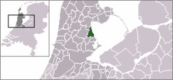
Beets (Dutch pronunciation: [ˈbeːts]) is a village in the northwest Netherlands. It is a part of the municipality of Edam-Volendam, North Holland, and lies about 9 km southwest of Hoorn.
Beets | |
|---|---|
Town | |
 Coat of arms | |
 | |
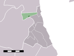 The village centre (darkgreen) and the statistical district (lightgreen) of Beets in the former municipality of Zeevang. | |
| Coordinates: 52°35′21″N 4°58′39″E | |
| Country | Netherlands |
| Province | North Holland |
| Municipality | Edam-Volendam |
| Area | |
| • Total | 4 km2 (2 sq mi) |
| Population (2009)[1] | |
| • Total | 541 |
| • Density | 140/km2 (350/sq mi) |
| Time zone | UTC+1 (CET) |
| • Summer (DST) | UTC+2 (CEST) |
| Postal code | 1475 |
| Dialing code | 0299 |
In 2001, the small village centre of Beets had 243 inhabitants. The built-up area of the town was 0.05 km², and contained 100 residences.[2] The statistical district "Beets", which covers the village and the surrounding countryside, has a population of around 550.[3]
Until 1970, Beets was a separate municipality.[4]
References
- Gemeente Zeevang (2009) "Gemeente in cijfers" Gemeentegids Amsterdam: De Telefoongids BV pp. 7.
- Statistics Netherlands (CBS), Bevolkingskernen in Nederland 2001 "Archived copy". Archived from the original on 2006-03-19. Retrieved 2007-01-24.CS1 maint: archived copy as title (link). Statistics are for the continuous built-up area.
- Statistics Netherlands, 2007. Figures are for the year 2006. Statistics are available in Google Earth format.
- Ad van der Meer and Onno Boonstra, Repertorium van Nederlandse gemeenten, KNAW, 2011.
External links
- J. Kuyper, Gemeente Atlas van Nederland, 1865-1870, "Beets". Map of the former municipality, around 1868.
This article is issued from Wikipedia. The text is licensed under Creative Commons - Attribution - Sharealike. Additional terms may apply for the media files.