Beechingstoke
Beechingstoke is a small village and civil parish in Wiltshire, England. It lies in the Vale of Pewsey about 5 miles (8 km) west of Pewsey and the same distance east of Devizes. The parish includes the hamlet of Broad Street and the northern part of the village of Bottlesford.
| Beechingstoke | |
|---|---|
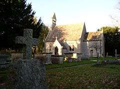
 St Stephen's Church, Beechingstoke | |
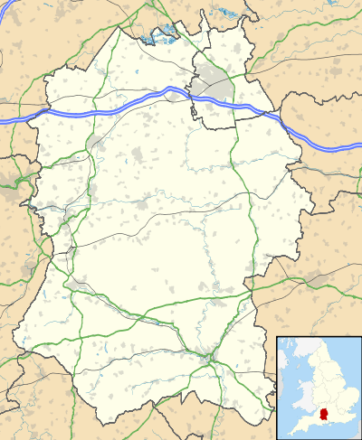
 Beechingstoke Location within Wiltshire | |
| Population | 157 (in 2011)[1] |
| OS grid reference | SU087592 |
| Unitary authority | |
| Ceremonial county | |
| Region | |
| Country | England |
| Sovereign state | United Kingdom |
| Post town | PEWSEY |
| Postcode district | SN9 |
| Dialling code | 01672 |
| Police | Wiltshire |
| Fire | Dorset and Wiltshire |
| Ambulance | South Western |
| UK Parliament | |
The River Avon and its small tributaries form parts of the west, south and northeast boundaries of the parish.
History
Marden Henge, a large Neolithic earthwork, is just over the southwest border of the parish. The Domesday Book of 1086 records Beechingstoke as held by Shaftesbury Abbey.[2] In 1541 the king transferred the land to the Dean of Winchester, who held it until 1845.[3]
In 1862 the Reading to Taunton railway was built close to Beechingstoke village and became the northern boundary of the parish. There was a station at Woodborough, just outside the parish to the north of Broad Street, but it closed in 1966 making Pewsey the nearest station.
Parish church
The earliest known record of the Church of England parish church of Saint Stephen is from 1291.[4] Of the mediaeval church building only the 14th century chancel arch and surrounding wall survive.[4] The nave was rebuilt in 1693 and the chancel in 1791.[4] In 1848 the 1791 east window was moved to Wilsford school and a new 15th-century style one was inserted in the chancel in its place.[4] The church was largely rebuilt again in 1861 under the direction of the architect S.B. Gabriel[5] of Bristol, who altered the east window to a 14th-century style and inserted a new west window.[4] The church is Grade II listed,[6] as is the nearby Old Rectory of c. 1830.[7]
Local government
Beechingstoke is a civil parish with an elected parish council. It is in the area of the Wiltshire Council unitary authority, which is responsible for all significant local government functions, and is represented in the council by Paul Oatway, who succeeded Brigadier Robert Hall in 2013.
Amenities
There is no school in the parish. A National school was built near the church shortly before 1859 but closed around 1872 when the school at nearby Woodborough was opened.[3]
References
- "Wiltshire Community History - Census". Wiltshire Council. Archived from the original on 4 March 2016. Retrieved 15 September 2015.
- Beechingstoke in the Domesday Book
- "Victoria County History - Wiltshire - Vol 10 pp14-19 - Parishes: Beechingstoke". British History Online. University of London. Retrieved 16 September 2015.
- Crittall et al., 1975, pages 14-19
- Pevsner & Cherry, 1975, page 106
- Historic England. "Church of St Stephen, Beechingstoke (1181938)". National Heritage List for England. Retrieved 16 September 2015.
- Historic England. "Old Rectory, Beechingstoke (1035783)". National Heritage List for England. Retrieved 16 September 2015.
Sources
- Crittall, Elizabeth (ed.); Baggs, A.P.; Crowley, D.A.; Pugh, Ralph B.; Stevenson, Janet H.; Tomlinson, Margaret (1975). Victoria County History: A History of the County of Wiltshire, Volume 10: Swanborough hundred; the borough of Devizes. pp. 14–19.CS1 maint: extra text: authors list (link)
- Pevsner, Nikolaus (1975). Cherry, Bridget (ed.). The Buildings of England: Wiltshire. Harmondsworth: Penguin Books. p. 106. ISBN 0-14-0710-26-4.
External links
![]()
- "Beechingstoke". Wiltshire Community History. Wiltshire Council. Archived from the original on 4 March 2016. Retrieved 16 September 2015.