Beaver Dam, Utah
Beaver Dam (also Beaverdam) is an unincorporated community on the northeastern edge of Box Elder County, Utah, United States.[1][2][3][4]
Beaver Dam, Utah | |
|---|---|
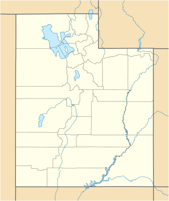 Beaver Dam Location of Beaver Dam within the State of Utah | |
| Coordinates: 41°48′34″N 112°03′32″W | |
| Country | United States |
| State | Utah |
| County | Box Elder |
| Settled | 1867 |
| Named for | The numerous beaver dams on Willow Creek |
| Elevation | 4,541 ft (1,384 m) |
| Time zone | UTC-7 (Mountain (MST)) |
| • Summer (DST) | UTC-6 (MDT) |
| ZIP code | 84306 |
| Area code(s) | 435 |
| GNIS feature ID | 1438527[1] |
History
Beaver Dam was settled in 1867 by people from the nearby communities of Providence and Deweyville and was named for the numerous beaver dams along nearby Willow Creek.[5]
In 1868, the first co-op dairy in Utah was established there.[5]
gollark: Hmm, this will have issues with the last pages though...
gollark: Not min.
gollark: I meant math.max.
gollark: To get the maximum page, add four to that.
gollark: To get the minimum page, take the current page, subtract three, math.min it with 1.
See also
![]()
References
- "Beaver Dam". Geographic Names Information System. United States Geological Survey.
- Google (8 Feb 2018). "15612 N Beaver Dam Rd, Collinston, Utah (Streetview)" (Map). Google Maps. Google. Retrieved 8 Feb 2018.
- "MyTopo Maps - Beaver Dam, UT, USA" (Map). mytopo.com. Trimble Navigation, Ltd. Retrieved 8 Feb 2018.
- "Look Up a ZIP Code: 84306". usps.com. United States Postal Service. Retrieved 8 Feb 2018.
- Van Cott, John W. (1990). Utah Place Names: A Comprehensive Guide to the Origins of Geographic Names: A Compilation. Salt Lake City: University of Utah Press. p. 26. ISBN 978-0-87480-345-7. OCLC 797284427. Retrieved 11 Feb 2018.
Municipalities and communities of Box Elder County, Utah, United States | ||
|---|---|---|
| Cities | 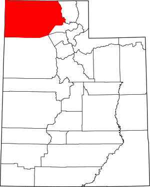 Map of Utah highlighting Box Elder County | |
| Towns | ||
| CDPs | ||
| Unincorporated areas | ||
| Ghost towns | ||
| Indian reservation | ||
This article is issued from Wikipedia. The text is licensed under Creative Commons - Attribution - Sharealike. Additional terms may apply for the media files.