Beaumotte-Aubertans
Beaumotte-Aubertans is a commune in the Haute-Saône department in the region of Bourgogne-Franche-Comté in eastern France.
Beaumotte-Aubertans | |
|---|---|
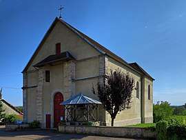
 The church in Beaumotte | |
 Coat of arms | |
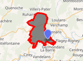
Location of Beaumotte-Aubertans 
| |
 Beaumotte-Aubertans  Beaumotte-Aubertans | |
| Coordinates: 47°25′15″N 6°10′48″E | |
| Country | France |
| Region | Bourgogne-Franche-Comté |
| Department | Haute-Saône |
| Arrondissement | Vesoul |
| Canton | Rioz |
| Government | |
| • Mayor | Ginette Parent |
| Area 1 | 13.57 km2 (5.24 sq mi) |
| Population (2017-01-01)[1] | 458 |
| • Density | 34/km2 (87/sq mi) |
| Time zone | UTC+01:00 (CET) |
| • Summer (DST) | UTC+02:00 (CEST) |
| INSEE/Postal code | 70059 /70190 |
| Elevation | 228–328 m (748–1,076 ft) |
| 1 French Land Register data, which excludes lakes, ponds, glaciers > 1 km2 (0.386 sq mi or 247 acres) and river estuaries. | |
Overview
The administrative district was created in 1973 by merging the villages of Beaumotte-lès-Montbozon and Aubertans. Originally named Beaumotte-lès-Montbozon-et-Aubertans, the commune was renamed Beaumotte-Aubertans in 1977.[2] The village of Aubertans is about 4.5 km to the north of the village now called Beaumotte-Aubertans.
The inhabitants of Beaumotte-Aubertans are called the Beaumottois, and the inhabitants of Aubertans are called the Aubertanois.
gollark: 376KB, but you know.
gollark: image/vnd.microsoft.icon you.
gollark: palaiologowebsite™ unfortunately seems to have a 400KB picture, which outweighs its generally good optimizations.
gollark: I went to significant effort to optimize the performance.
gollark: You may direct it here, to my email, or to random places in the comments section.
References
- INSEE (in English)
- "Populations légales 2017". INSEE. Retrieved 6 January 2020.
- INSEE: Official code
| Wikimedia Commons has media related to Beaumotte-Aubertans. |
This article is issued from Wikipedia. The text is licensed under Creative Commons - Attribution - Sharealike. Additional terms may apply for the media files.