Beaumont Island (Greenland)
Beaumont Island (Danish: Beaumont Ø) is an island of the Lincoln Sea, Greenland.[2] Administratively it belongs to the Northeast Greenland National Park.
| Beaumont Ø | |
|---|---|
 Beaumont Island | |
| Geography | |
| Location | Lincoln Sea |
| Coordinates | 82.78333°N 50.0°W |
| Area | 10.5 km2 (4.1 sq mi)[1] |
| Length | 4.3 km (2.67 mi) |
| Width | 3.5 km (2.17 mi) |
| Highest elevation | 399 m (1,309 ft) |
| Administration | |
| Zone | Northeast Greenland National Park |
| Demographics | |
| Population | 0 |
The inclusion of this island in determining the international boundary between Canadian and Danish waters has become a subject of disagreement following a 1973 treaty that left parts of the offshore boundary undefined.[3]
Geography
Beaumont Island lies in the Lincoln Sea to the NNW of the mouth of Victoria Fjord. It is located almost 40 km NNE of Cape May, at the northern end of Wulff Land and 20 km west of John Murray Island. The waters around the island are icebound most of the year.
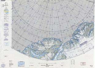 Map of part of Ellesmere Island and far Northern Greenland. |
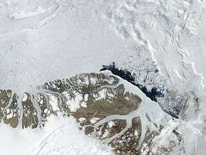 MODIS Satellite Image of Northern Greenland |
gollark: Yes, it would be possible to link to and from that.
gollark: No.
gollark: Maybe also stuff like discussion of apioforms in an easier to link to way?
gollark: Indeed, horse.
gollark: Anyway, what sort of *uses* would Apioforum have? Long term documentation things? Deployment of bee?
Bibliography
- Michael Byers, Who Owns the Arctic?: Understanding Sovereignty Disputes in the North
- George Nares Narrative of a voyage to the Polar Sea during 1875–6 in H.M. ships 'Alert' and 'Discovery'
References
- Michael Byers, International Law and the Arctic, p. 47
- "Beaumont Ø". Mapcarta. Retrieved 9 March 2019.
- "Canada and Kingdom of Denmark Reach Tentative Agreement on Lincoln Sea Boundary Backgrounder". Foreign Affairs and International Trade Canada. 2012. Archived from the original on 22 February 2014. Retrieved 16 February 2014.
External links
This article is issued from Wikipedia. The text is licensed under Creative Commons - Attribution - Sharealike. Additional terms may apply for the media files.