Beaubassin East, New Brunswick
Beaubassin East (2016 population: 6,376[1] ) is a Canadian Rural Community in Westmorland County, New Brunswick. The French form of the name is Beaubassin-Est.
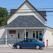
Beaubassin East (Grand Barachois) post office
History
Incorporation
The rural community was incorporated on May 8, 1995[2] from the Local Service Districts of Boudreau West, Grand Barachois, Haute-Aboujagane, and Saint-André & LeBlanc Office, and portions of the parishes of Botsford, Sackville, and Shediac. It completely surrounds the village of Cap-Pelé.
Beaubassin East is divided into six wards,[3] numbered counterclockwise from its eastern boundary.
- Ward 1 includes Bas-Cap-Pelé, Petit-Cap, Portage, and Shemogue
- Ward 2 includes Saint-André-LeBlanc
- Ward 3 includes Grand-Barachois
- Ward 4 includes Boudreau-Ouest
- Ward 5 includes Haute-Aboujagane
- Ward 6 includes Cormier-Village
In 2006, Trois-Ruisseaux became part of Beaubassin East.[4]
Demographics
| Canada census – Beaubassin East, New Brunswick community profile | |||
|---|---|---|---|
| 2016 | 2011 | ||
| Population: | 6,376 (+2.8% from 2011) | 6,200 (-3.6% from 2006) | |
| Land area: | 291.08 km2 (112.39 sq mi) | 291.12 km2 (112.40 sq mi) | |
| Population density: | 21.9/km2 (57/sq mi) | 21.3/km2 (55/sq mi) | |
| Median age: | 49.6 (M: 49.9, F: 49.4) | ||
| Total private dwellings: | 3,388 | 3,296 | |
| Median household income: | $68,894 | ||
| References: 2016[5] 2011[6] earlier[7] | |||
| Canada 2016 Census | Population | % of Total Population | |
|---|---|---|---|
| Visible minority group Source:[8] | South Asian | 0 | 0.2% |
| Chinese | 10 | 0.2% | |
| Black | 0 | 0% | |
| Filipino | 40 | 0.6% | |
| Latin American | 25 | 0.4% | |
| Arab | 10 | 0.2% | |
| Southeast Asian | 10 | 0.2% | |
| West Asian | 0 | 0% | |
| Korean | 0 | 0% | |
| Japanese | 0 | 0% | |
| Other visible minority | 10 | 0.2% | |
| Mixed visible minority | 15 | 0.2% | |
| Total visible minority population | 115 | 1.8% | |
| Aboriginal group Source:[9] | First Nations | 55 | 0.9% |
| Métis | 40 | 0.6% | |
| Inuit | 10 | 0.2% | |
| Other Aboriginal | 10 | 0.2% | |
| Total Aboriginal population | 115 | 1.8% | |
| European | 6,260 | 98.2% | |
| Total population | 6,376 | 100% | |
Notable people
gollark: This is silly. The body is much more messy and complicated than human machines with actual design. Blood carries lots of "data" too in the form of hormones and immune system hardware.
gollark: Tiger Lake goes up to 96EUs, if I IIRC.
gollark: ÆÆÆÆÆÆÆæ embeds.
gollark: Similar-looking images are considered reposts. I tested it a bit, but it's difficult to get around it without making an image look substantively different.
gollark: It uses a perceptual hash thing, not exact file matching.
See also
- List of rural communities in New Brunswick
- Greater Shediac
Places adjacent to Beaubassin East, New Brunswick | ||||||||||
|---|---|---|---|---|---|---|---|---|---|---|
| ||||||||||
References
- "Census Profile, 2016 Census: Beaubassin East". Statistics Canada. Retrieved August 10, 2019.
- "Rural Community of Beaubassin East Regulation - Municipalities Act". Archived from the original on March 6, 2005. Retrieved 2011-11-09.
- "Beaubassin Wards Map" (PDF). Retrieved November 9, 2011.
- Government of Canada, 2006 Amalgamation.
- "2016 Community Profiles". 2016 Canadian Census. Statistics Canada. February 21, 2017. Retrieved 2019-08-10.
- "2011 Community Profiles". 2011 Canadian Census. Statistics Canada. July 5, 2013.
- "2001 Community Profiles". 2001 Canadian Census. Statistics Canada. February 17, 2012.
- "Census Profile, 2016 Census Beaubassin East (Topic: Visible Minority)". 2016 Census. Statistics Canada. Retrieved August 10, 2019.
- "Census Profile, 2016 Census Beaubassin East (Topic: Aboriginal Peoples)". 2016 Census. Statistics Canada. Retrieved August 10, 2019.
| Cities | |
|---|---|
| Rural Communities | |
| Towns | |
| Villages | |
| Parishes | |
| First Nations Reservations |
|
| |
| Subdivisions |
|
|---|---|
| Cities | |
| Rural communities | |
| |
This article is issued from Wikipedia. The text is licensed under Creative Commons - Attribution - Sharealike. Additional terms may apply for the media files.