Bauges
The Bauges Mountains (Massif des Bauges) is a mountain range in eastern France, stretching from the city of Annecy to the city of Chambéry, which is part of the French Prealps.

View from the southern part of the Bauges -

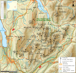
Map of the Bauges mountains
Major peaks
The Bauges have 14 summits above 2,000 metres (6,562 ft):
- Arcalod, 2,217 m (7,274 ft), highest point in the range
- Sambuy, 2,198 m (7,211 ft)
- Pécloz, 2,197 m (7,208 ft)
- Trélod, 2,181 m (7,156 ft)
- Pointe de Chaurionde, 2,173 m (7,129 ft)
- Mont d’Armenaz, 2,158 m (7,080 ft)
- Pointe des Arces, 2,076 m (6,811 ft)
- Mont de la Coche, 2,070 m (6,791 ft)
- Dent de Cons, 2,064 m (6,772 ft)
- Pointe des Arlicots, 2,060 m (6,759 ft)
- Mont Colombier, 2,043 m (6,703 ft)
- Dent d’Arclusaz, 2,040 m (6,693 ft)
- Grand Parra, 2,012 m (6,601 ft)
Other noteworthy summits include:
- Montagne du Charbon, 1,932 m (6,339 ft)
- Semnoz, 1,699 m (5,574 ft), above Annecy
- Nivolet, 1,547 m (5,075 ft), above Chambéry
- Mont Revard, 1,562 m (5,125 ft), above Aix-les-Bains
- Mont Peney, 1,356 m (4,449 ft)
gollark: It's vaguely weird how the whole cultural thing of guns and whatnot is completely absent here in the UK, because of the "ban everything remotely dangerous" attitude here.
gollark: In the picture I mean.
gollark: There are some numbers on what looks like a power supply.
gollark: I really wonder about those people with 15GB.
gollark: "Unlimited" seemingly meaning "1TB a month then you get a lower speed".
This article is issued from Wikipedia. The text is licensed under Creative Commons - Attribution - Sharealike. Additional terms may apply for the media files.