Bargur
Bargur (also known as Barugur or Barguru) is a town panchayat and Taluk in Krishnagiri district in the state of Tamil Nadu, India. The economy is dependent on important textile and Textile trading, Granite import, mango cultivation and oriented processing industries.
Bargur | |
|---|---|
Town | |
| Nickname(s): Mini Surat \ gethu place | |
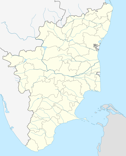 Bargur Location in Tamil Nadu, India | |
| Coordinates: 12.55°N 78.37°E | |
| Country | |
| State | Tamil Nadu |
| Region | Kongu Nadu |
| District | Krishnagiri |
| Government | |
| • Type | State Assembly Constituency |
| • Body | Town Panchayat and Taluk |
| • Member of Legislative Assembly | C.VEE.RAJENDRAN (AIADMK) |
| • Member of Parliament | Dr.A.Chellakumar(Indian National Congress (INC) ). |
| Elevation | 533 m (1,749 ft) |
| Population (2011) | |
| • Total | 16,366 |
| Languages | |
| • Official | Tamil |
| • Spoken | Telugu, Tamil, Kannada |
| Time zone | UTC+5:30 (IST) |
| PIN | 635 104 |
| Telephone code | (91)4343 |
| Vehicle registration | TN-24 |
| Website | http://www.krishnagiri.tn.nic.in/links.htm |
Bargur (also known as Barguru) is one of the important textile market based urban centre in Northern Districts of Tamil Nadu State. Because of its textile markets it is called as Mini Surat. Bargur, a Selection Grade Town Panchayat located in Krishnagiri District, was constituted on 1969 by merging eight hamlets. Bargur Town spreads across an extent of 22.50 km2 and it is divided into 15 wards. Bargur town is located along Chennai – Krishnagiri National Highway (NH – 46). The town is surrounded in all directions by small numerous hillocks. The town has gained its importance because of Textiles Export, Granite Export, Mango, Coconut and Banana cultivation.
BARGUR TOWN PANCHAYAT
URBAN GOVERNANCE
Bargur, Selection Grade Town Panchayat is divided into 15 wards. Bargur town is constituted by 8 rural habitations. There are 15 ward members including a Chairperson. Out of 15 wards, 5 wards (Ward 2, 4, 6, 8 & 10) are reserved for general women and 2 wards (8 & 14) reserved for schedule caste.
a) Date of declaration:The town panchayat was formed on 1/10/1969 declared as 1st Grade Town Panchayat as per Go.No. 1658 / RD & LA dt. 3.10.69.
b) Date of Up gradation:As per the Director of Town Panchayats Roc No. 2197 Dated 14.2.1985, the town panchayat was up graded as a Selection Grade Town Panchayat.
1) Kothur, 2) Kothiyalaganoor, 3) Jaginikollai, 4) Neralakottai, 5) Pumalai Nagar, 6) M.G.R Nagar, 7) Kamaraj colony, 8) Durai's Nagar. STRUCTURE OF LOCAL GOVERNANCE
    Chairman of Council(1)
     |
    Vice Chairman(1)
     |
    Ward Councilor(15)
STRUCTURE OF URBAN GOVERNANCE
Executive officer
|
Head Clerk
|
Junior             BILL
Assistant(3)      Collector(4)
|
Record Clerk(1)
|
Technical Assistant(1)
|
Office Assistant(1)
Executive officer
|
Sanitary Inspector(1)
|
Sanitary Supervisor(2)
|
Sanitary workers(31)
Executive officer
|
   Pump       Electrician
    Operator
|
Fitter
BARGUR REVENUE VILLAGES
Bargur is one of the main revenue block in the district and It has a total of 36 panchayat villages. Achamangalam, Anchor, Balinayanapalli, Bandaseemanor, Batalapalli, Belathottam, Belavarthi, Chinnamettrapalli, Guruvinayanapalli, Gutur, Ikondakothapalli, Jagadevi, Jingalkathirampatti, Kajeethgollahalli, Kandikuppam, Karakuppam, Kurumber Theru, Kondanayanapalli, Kottagaram, Kulampatti, Madepalli, Mahadevagollapalli, Mallapadi, Oppathavadi, Orappam, Palapalli, Parandapalli, Perugobanapalli, Pochampalli, Puliyampatti, Singaralpatti, Sollamalai, Thadampatti, Thogarapalli, Valasagoundanoor, Varattanapalli, Veppalampatti.
Geography
Bargur is located at 12.55°N 78.37°E.[1] It has an average elevation of 533 m (1,749 ft).
Demographics
As per the Census India 2011,
| Number of Households | 3,760 |
| Population | 16,366 |
| Male Population | 8,316 (50.81%) |
| Female Population | 8,050 (49.19%) |
| Children Population | 1,810 |
| Sex-ratio | 968 |
| Literacy | 70.87% |
| Male Literacy | 76.18% |
| Female Literacy | 65.38% |
| Scheduled Tribes (ST) % | 1.27% |
| Scheduled Caste (SC) % | 10.58% |
Bargur has population of 16,366 of which 8,316 are males and 8,050 are females. The population of children between age 0-6 is 1,810 which is 11.06% of total population. The sex-ratio of Bargur is around 968 compared to 996 which is average of Tamil Nadu state. The literacy rate of Bargur is 70.87% out of which 76.18% males are literate and 65.38% females are literate. There are 10.58% Scheduled Caste (SC) and 1.27% Scheduled Tribe (ST) of total population in Bargur. [2]
Tamil is the official language and Telugu is the majorly spoken language in the town. As per 2001 census, Telugu speakers are 6,621, Tamil speakers are 5,209, Kannada speakers are 2,250.[3]
Education
COLLEGES
There is a Government College of Engineering started on 9 September 1994 and housed temporarily in two buildings of the Government Polytechnic, Krishnagiri. It was later shifted in July 2000 to its own 50-acre (200,000 m2) campus in Bargur, located at latitude = 12.548°, longitude =78.334° on a site surrounded by hills on the National Highway 46 (NH46) about 10 km East from Krishnagiri and between Vaniyambadi and Krishnagiri and a Government Women's Arts and Science college at Bargur.
SCHOOLS
| ° Government Boys Higher Secondary school Bargur |
| ° Government Girls Higher Secondary school Bargur |
| ° Government Primary School Kurumber Theru |
| ° Concordia higher secondary school Bargur |
| ° Vailankanni Matriculation Higher Secondary School Bargur |
| ° Kingsley Garden Matriculation Higher Secondary School Kandikuppam |
| ° Selva Matriculation Higher Secondary School Madepalli |
| ° St.Paul's Matriculation School |
| ° St.Kanakadasa Matriculation Higher Secondary school Bargur |
| ° Government Primary school KOTHUR |
Peoples Profile
Out of total population, 6,404 were engaged in work or business activity. Of this 4,694 were males while 1,710 were females. In census survey, worker is defined as person who does business, job, service, and cultivator and labour activity of total 6404 working population, 77.62% were engaged in Main Work while 22.38% of total workers were engaged in Marginal Work.
Transport
Bargur is well connected to various parts of India through several National Highways that include Krishnagiri–Ranipet NH 46, Puducherry–Krishnagiri NH 66.
Bargur connects Krishnagiri to 3 different states i.e. Tamil Nadu, Karnataka and Andhra Pradesh. It connects Vellore district Thiruppattur, Vaniyampadi.
Nearest railway station is Jolarpet.
Politics
Bargur, Selection Grade Town Panchayat is divided into 15 wards. Bargur town is constituted by 8 rural habitations. There are 15 ward members including a Chairperson. Out of 15 wards, 5 wards (Ward 2, 4, 6, 8 & 10) are reserved for general women and 2 wards (8 & 14) reserved for schedule caste.
Bargur is a State Assembly Constituency of Tamil Nadu is represented by AIADMK politician C.VEE.RAJENDARAN.
Bargur assembly constituency is part of Krishnagiri (Lok Sabha constituency). In the Parliament of India, Krishnagiri Lok Sabha Constituency is represented by Indian National Congress (INC) politician Dr. A. Chellakumar .
Bargur SIPCOT
| S.# | Name of the Complex/Park | Bargur Industrial Complex. |
| 1. | Location | About 17 km from Krishnagiri. |
| 2. | Allottable area | 606.16 acres |
| 3. | Area now available for allotment | 455.49 acres |
| 4. | Connectivity | |
| Nearest Railway Station | Jolarpet 46 km | |
| Nearest Airport | Bangaluru 120 km | |
Major Industries(Foreign Companies)
1. M/s. Samalpatti Power Company P Ltd
2. M/s. Synergy Shakthi Renewable Energy Ltd
3. M/s. BM Continental Granites & Marbles Ltd
References
- Falling Rain Genomics, Inc – Bargur
- https://www.censusindia2011.com/tamil-nadu/krishnagiri/krishnagiri/bargur-tp-population.html
- "WELCOME TO CENSUS OF INDIA : Census India Library". www.censusindia.gov.in. Retrieved 18 November 2015.
- Rain Gauge to be installed
http://www.thehindu.com/2005/07/31/stories/2005073101680300.htm - Bargur Industrial Complex.
https://www.sipcot.com/Navigation.html?lat=12.3023567&long=78.4068489&content=Bargur&index=1&noi=1