Bardera Airport
Bardera Airport (IATA: BSY[3], ICAO: HCMD) is an airport serving Bardera, a city in the southern Gedo region in Somalia.[1][2]
Bardera Airport | |||||||||||
|---|---|---|---|---|---|---|---|---|---|---|---|
| Summary | |||||||||||
| Airport type | Public | ||||||||||
| Owner | Somali Civil Aviation Authority | ||||||||||
| Serves | Bardera, Somalia | ||||||||||
| Elevation AMSL | 550 ft / 168 m | ||||||||||
| Coordinates | 02°20.203′N 042°18.462′E | ||||||||||
| Map | |||||||||||
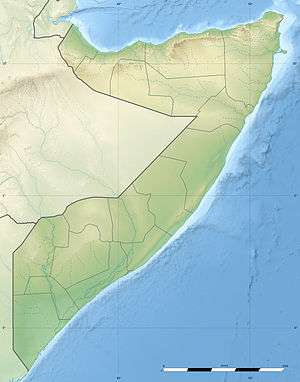
 BSY Location of the airport in Somalia | |||||||||||
| Runways | |||||||||||
| |||||||||||
Facilities
The airport resides at an elevation of 550 feet (168 m) above mean sea level.[1] It has one runway designated 15/33 with a compacted sand surface measuring 1,300 by 30 metres (4,265 ft × 98 ft).[1]
gollark: Eh, Rust makes big binaries and probably won't let me do some insane dubious hackery which could help.
gollark: If I rewrote it as a really compact C program with no external dependencies (except maybe libc) I suppose it would have a number of advantages.
gollark: So good enough, really. Making viruses spread is hard. I guess it could detect USB sticks or (if it was smaller) somehow append itself to executables you compile.
gollark: But it slightly hides itself and runs automatically and runs commands I send and whatnot.
gollark: Also, the tool I use to compile it to a binary isn't very good.
References
- "BARDERA" (PDF). Operation Somalia: Airfield Specifications. Logistics Cluster. Archived from the original (PDF) on 3 November 2013. Retrieved 23 September 2013.
- "Bardera Airport (IATA: BSY, ICAO: HCMD), Somalia". Aviation Safety Network. Retrieved 23 September 2013.
- "IATA Airport Code Search (BSY: Bardera)". International Air Transport Association. Retrieved 23 September 2013.
This article is issued from Wikipedia. The text is licensed under Creative Commons - Attribution - Sharealike. Additional terms may apply for the media files.