Barberena
Barberena is a town, with a population of 47,093 (2018 census),[3] and a municipality in Santa Rosa department of Guatemala. Filled with local vendors and stores selling American goods, Barberena is a small town typical of the Guatemalan countryside.
Barberena | |
|---|---|
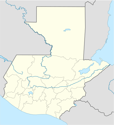 Barberena Location in Guatemala | |
| Coordinates: 14°19′N 90°22′W | |
| Country | |
| Department | |
| Government | |
| • Mayor (2016–2020) | Víctor Jiménez |
| Area | |
| • Total | 89 sq mi (231 km2) |
| Elevation | 3,507 ft (1,069 m) |
| Population (2018 census)[2] | |
| • Total | 58,276 |
| • Density | 650/sq mi (250/km2) |
| Climate | Aw |
Due to its close proximity to many rural communities, Barberena plays a central role in the local economy, especially as a point of exchange for agricultural goods and manufactured products. The crime rate is especially high, as in much of Guatemala.
History
1913 earthquake
On Saturday 8 March 1913 and magnitude 6.4 earthquake hit Santa Rosa, destroying its department capital, Cuilapa.[4] Both the initial quake and the replicas destroyed a lot of private homes, and also the cathedral and the prison, leaving behind significant human losses; similar destruction occurred at Barberena, Cerro Redondo, Llano Grande and El Zapote.[4] Fraijanes, Pueblo Nuevo Viñas, Coatepeque and Jalpatagua were also affected.[4] Around Cuilapa, there were landslides and road blockades, and even a long crack was reported at Los Esclavos hill.[4]
Climate
Barberena tropical climate (Köppen: Aw).
| Climate data for Barberena | |||||||||||||
|---|---|---|---|---|---|---|---|---|---|---|---|---|---|
| Month | Jan | Feb | Mar | Apr | May | Jun | Jul | Aug | Sep | Oct | Nov | Dec | Year |
| Average high °C (°F) | 26.4 (79.5) |
27.5 (81.5) |
28.6 (83.5) |
28.3 (82.9) |
27.9 (82.2) |
26.5 (79.7) |
27.1 (80.8) |
26.9 (80.4) |
26.3 (79.3) |
26.3 (79.3) |
25.9 (78.6) |
25.9 (78.6) |
27.0 (80.5) |
| Daily mean °C (°F) | 20.5 (68.9) |
21.4 (70.5) |
22.2 (72.0) |
22.6 (72.7) |
22.7 (72.9) |
22.0 (71.6) |
22.3 (72.1) |
22.1 (71.8) |
21.9 (71.4) |
21.7 (71.1) |
20.8 (69.4) |
20.5 (68.9) |
21.7 (71.1) |
| Average low °C (°F) | 14.7 (58.5) |
15.3 (59.5) |
15.8 (60.4) |
17.0 (62.6) |
17.5 (63.5) |
17.6 (63.7) |
17.5 (63.5) |
17.3 (63.1) |
17.5 (63.5) |
17.1 (62.8) |
15.7 (60.3) |
15.2 (59.4) |
16.5 (61.7) |
| Average precipitation mm (inches) | 10 (0.4) |
7 (0.3) |
17 (0.7) |
65 (2.6) |
253 (10.0) |
320 (12.6) |
271 (10.7) |
275 (10.8) |
378 (14.9) |
304 (12.0) |
56 (2.2) |
15 (0.6) |
1,971 (77.8) |
| Source: Climate-Data.org[5] | |||||||||||||
Geographic location
Barberena is surrounded by Santa Rosa Department municipalities, except on the West, where it borders with Escuintla Department:[6]
Places adjacent to Barberena | |
|---|---|
See also

- List of places in Guatemala
Notes and references
References
- "Alcaldes electos en el departamento de Santa Rosa". Municipalidades de Guatemala (in Spanish). Guatemala. 7 September 2015. Archived from the original on October 30, 2015. Retrieved 30 October 2015.CS1 maint: ref=harv (link)
- Citypopulation.de Population of departments and municipalities in Guatemala
- Citypopulation.de Population of cities & towns in Guatemala
- Ambraseys & Adams 2001, pp. 72–73
- "Climate: Barberena". Climate-Data.org. Retrieved 23 January 2016.CS1 maint: ref=harv (link)
- "Municipios del departamento de Santa Rosa". SEGEPLAN (in Spanish). Guatemala. Archived from the original on July 7, 2015. Retrieved 30 October 2015.CS1 maint: ref=harv (link)
Bibliography
- Ambraseys, Nicholas; Adams, Robin A. (2001). The Seismicity of Central America; a descriptive catalogue 1898–1995. World Scientific. p. 309. ISBN 9781860942440.CS1 maint: ref=harv (link)
Capital: Cuilapa | ||
| Municipalities |  | |