Bailadila Range
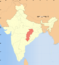
Bailadila Range, is a mountain range rising in the Deccan Plateau about 200 km west of the Eastern Ghats. It has been named 'Bailadila' because it resembles the hump of an ox. It is located near Kirandul town in the Dantewada district of southern Chhattisgarh, India.[1]
| Bailadila Mountain Range | |
|---|---|
 Location of the Bailadila Range in Chhattisgarh | |
| Highest point | |
| Peak | Unnamed hill, Dantewada district, Chhattisgarh, India |
| Elevation | 1,276 m (4,186 ft) |
| Listing | List of Indian states and territories by highest point |
| Dimensions | |
| Length | 70 km (43 mi) SW-NE |
| Width | 25 km (16 mi) NW-SE |
| Geography | |
| Country | India |
| State | Chhattisgarh |
| Range coordinates | 18°42′00″N 81°13′10″E |
| Climbing | |
| Easiest route | Hike |
Highest point in Chhattisgarh
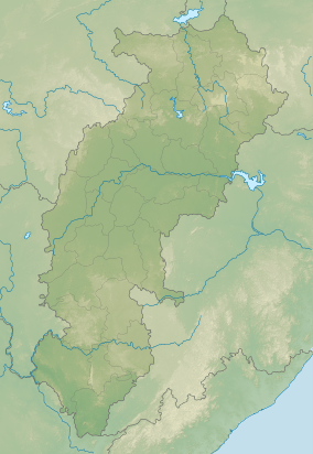
The range is located in the northeastern area of the Deccan Plateau. It extends in a roughly SW - NE direction for a length of about 70 km south of the Indravati River.[2] Rising to a height of 1,276 m, one of the hills of the Bailadila Range is the highest point in the state of Chhattisgarh.
The hills are located at a distance of about 40 km south west of Dantewada, the district headquarters in the state.[3] Formerly the Bailadila slopes were thickly wooded, but the range has been a mining area producing very high grade iron ore and the mineral extraction has left many areas of the mountains scarred.[4]
See also
References
- Bailadila Hills, Dantewada district, Chhattisgarh
- Geographical Features of the Flora of the Bailadila Range in Bastar State
- The Journal of the Bombay Natural History Society - Google Books
- "National Mineral Development Corporation, Dantewada district, Chhattisgarh". Archived from the original on 2017-03-01. Retrieved 2015-10-21.
External links
Capital: Raipur (Current) Naya Raipur (Future) | ||
| Governance |
|  |
| Topics | ||
| Divisions |
| |
| Districts | ||
| Cities | ||
| ||